|
George Willdey Samuel Parker |
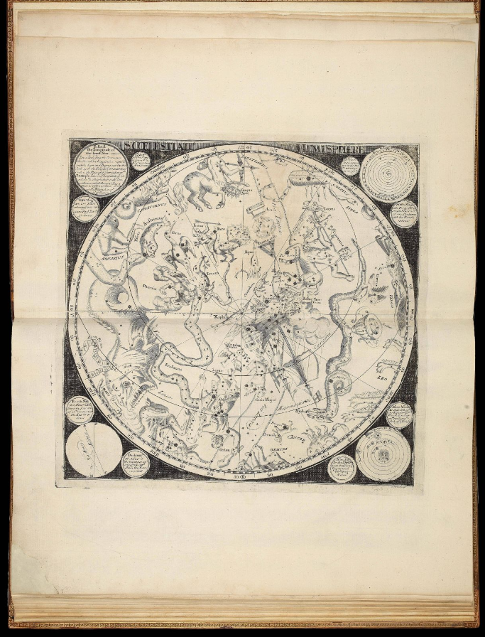
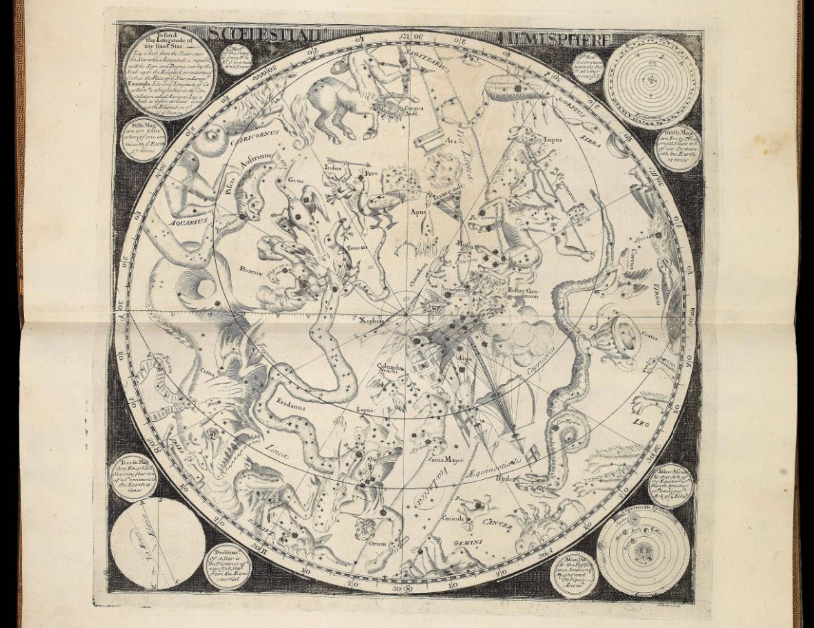
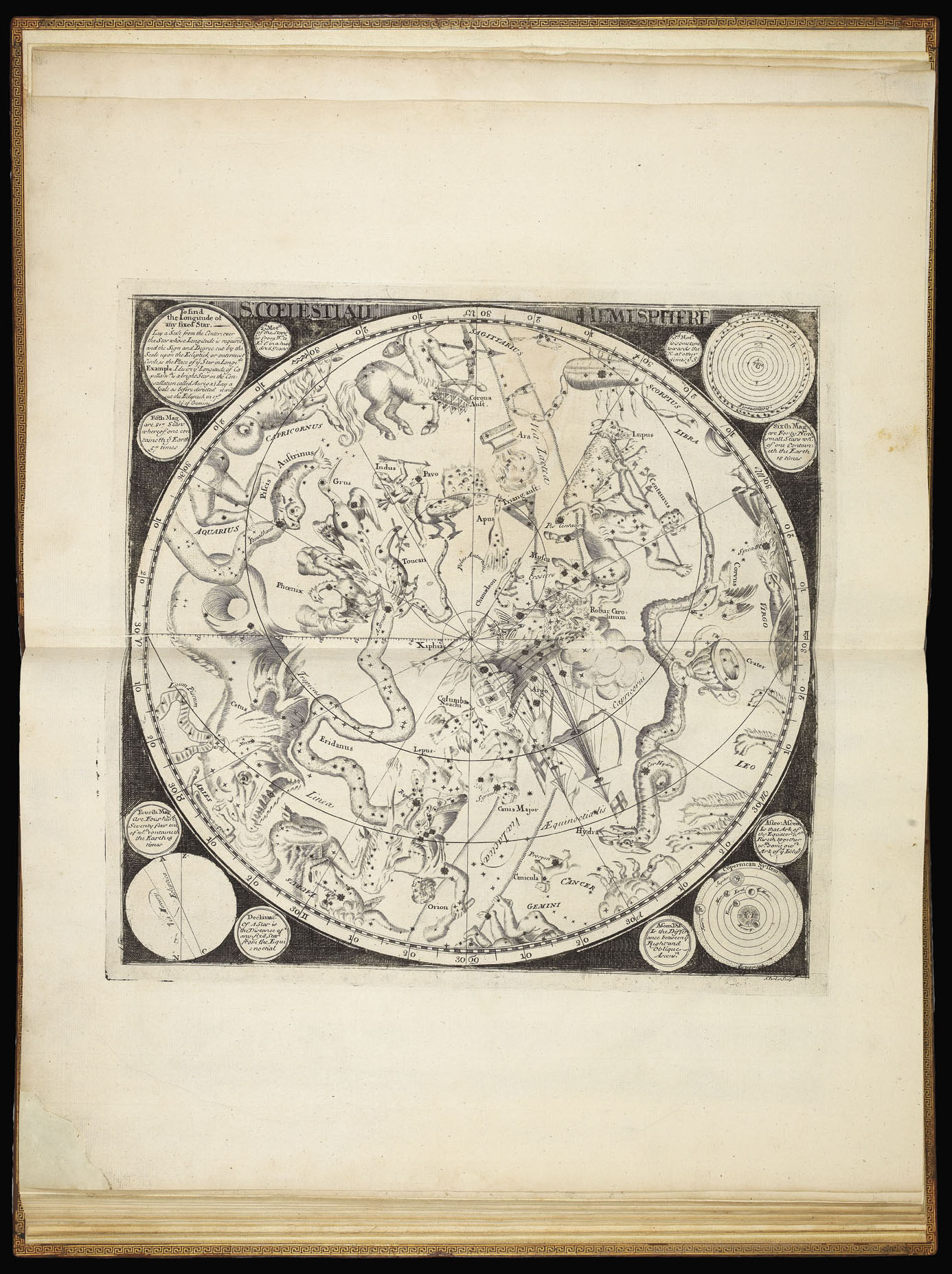
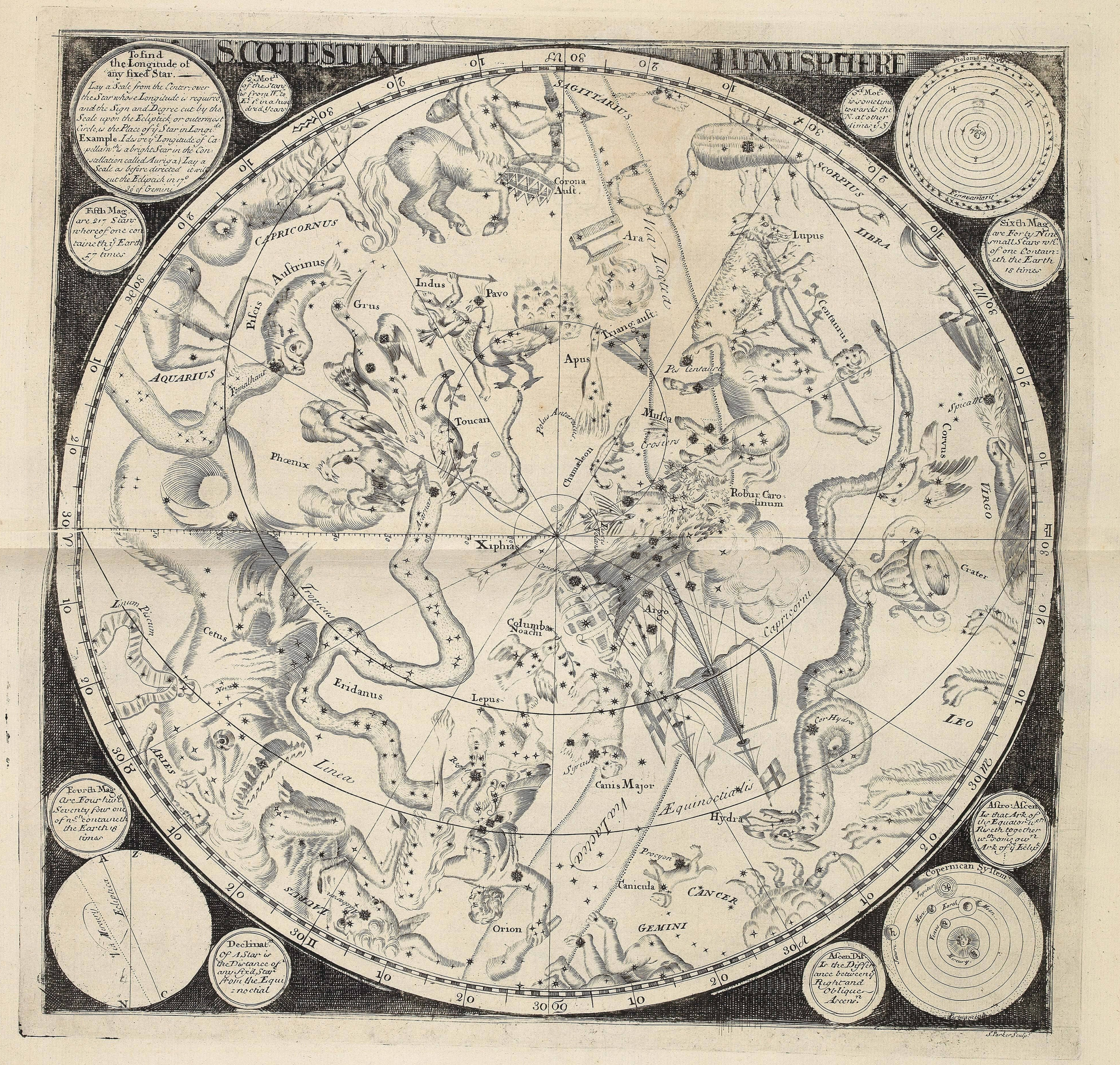
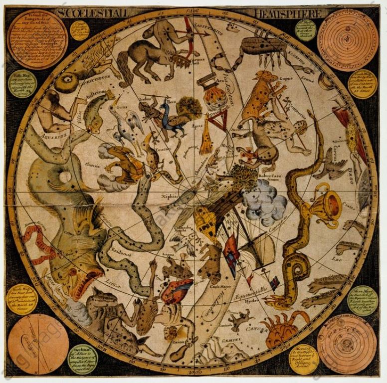
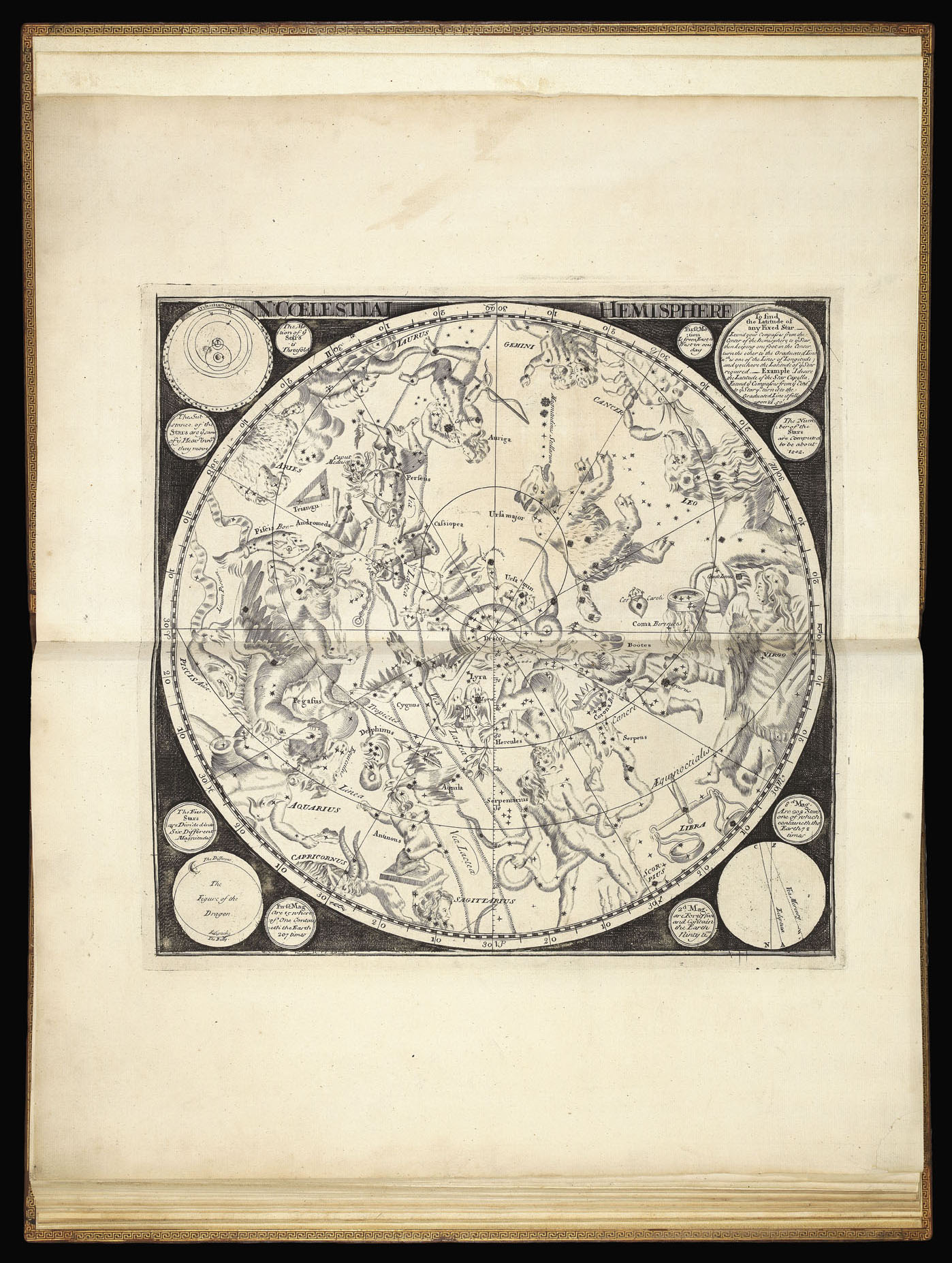
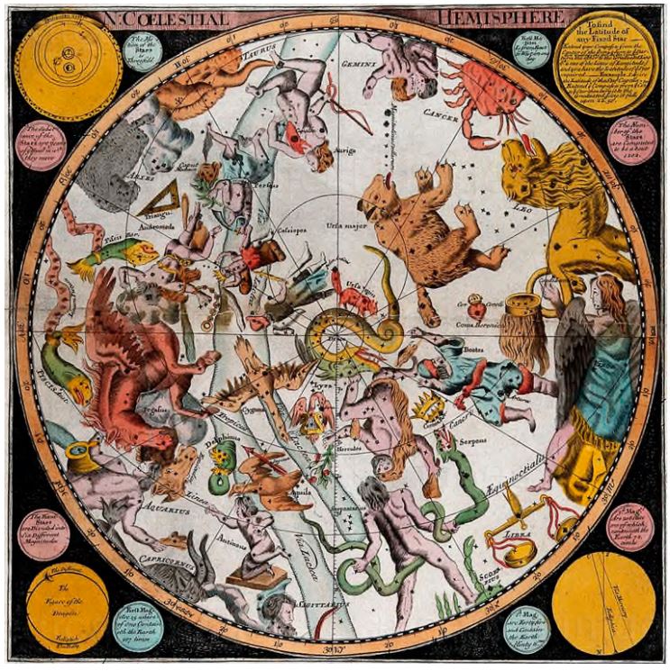
S: Coelestial Hemisphere e N: Coelestial Hemisphere in Composite Atlas, London 1721
|
Samuel Parker
S: Coelestial Hemisphere
e
N: Coelestial Hemisphere
in
George Willdey
Composite Atlas, London 1721
I due
emisferi celesti di
George Willdey,
incisi da
Samuel Parker,
sono costruiti
in proiezione stereografica polare eclittica e in
visione concava, rappresentano il cielo boreale e quello meridionale dai
rispettivi poli eclittici fino al cerchio dell’eclittica che fa da perimetro. Le
stelle, posizionate per l’epoca, sono graduate in sei classi di magnitudine, per
le più luminose viene indicato il nome proprio.
In ognuna delle mappe del reticolo eclittico viene disegnato il polo, il circolo polare , le linee di longitudine ogni 30°. La longitudine è leggibile sul perimetro esterno dell’eclittica al passo di un grado, numerata ogni 10°. Il reticolo equatoriale non riporta graduazioni ed è rappresentato dal polo e dal circolo polare , dal cerchio del Tropico e da un arco della proiezione dell’equatore.
Le due tavole, identiche, vennero ripresentate nel 1790 da James Barlow:
http://www.atlascoelestis.com/Barlow%201790%20base.htm
Ripropongo le due tavole celesti e alcune delle altre caratteristiche tavole geografiche dell’atlante per cortesia di
Daniel Crouch Rare Books
https://www.crouchrarebooks.com/atlases/willdeys-rare-composite-atlas
https://www.crouchrarebooks.com/discover/mapmakers/willdey-george
che ha messo recentemente in vendita la rara opera presentandola con la seguente scheda:
Author: WILLDEY, George
Title: Composite atlas
Publication place: London
Publication date: c1721
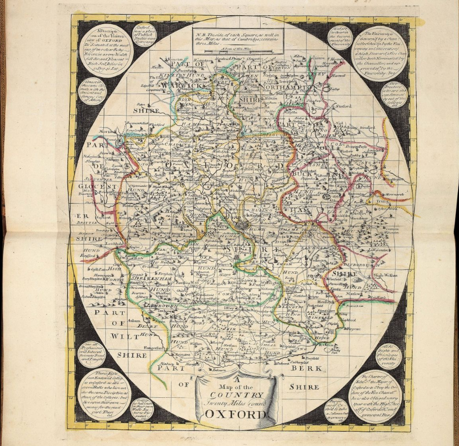
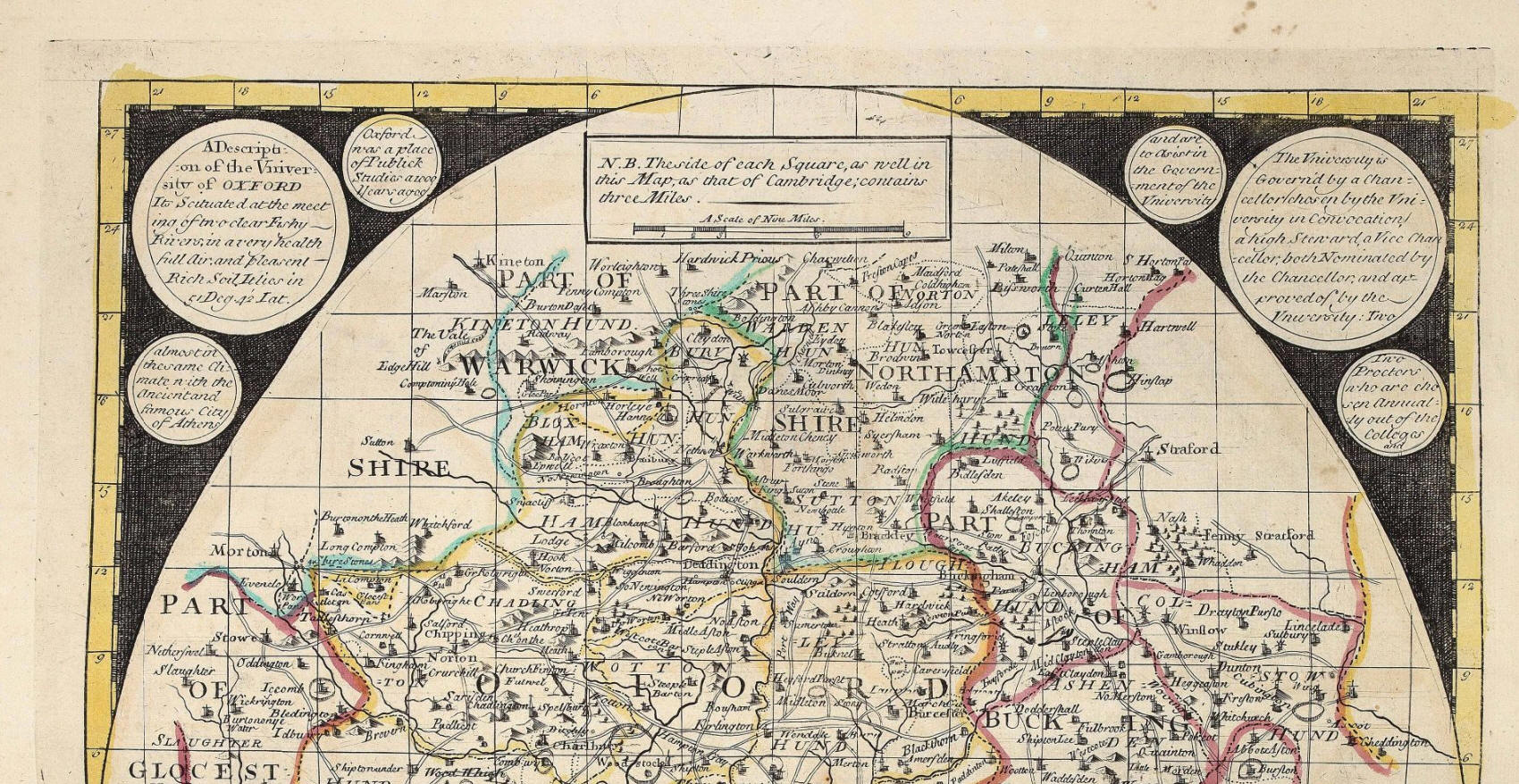
Physical description: Large folio (482 by 317 mm). 21 double page maps, 19 in original outline hand colour, brown calf, gilt, turn-ins gilt, spine divided into six compartments by raised bands, gilt fillets and title in gilt lettering.
Inventory reference: 12621
Notes
A composite atlas by George
Willdey, made up of unusual round maps with information about the areas
portrayed included in small roundels in the black border surrounding the
cartographical elements. Although the atlas has no title page, it was in all
likelihood compiled by Willdey’s establishment. The maps are almost identical to
the series advertised by Willdey in ‘Post
Man’ (issue 4112) on the 23rd-25th November 1721:
“a Set of 20 different New Sheet Maps, of the Principal Kingdoms and
States of Europe, with particular Historical Explanations to each Map, so as to
make it when put together, with its proper Colours and Illuminations, one of the
largest, beautifullest, most useful, and diverting Ornaments, as well as best
Set of Geography ever yet done of this kind; the Names of the Maps aforesaid,
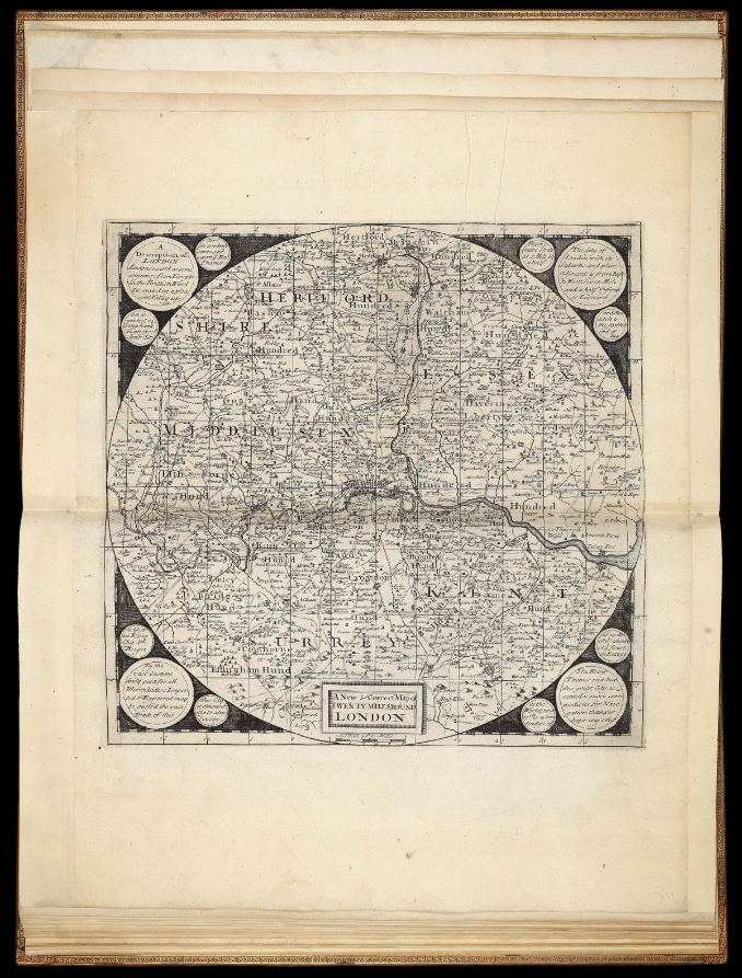
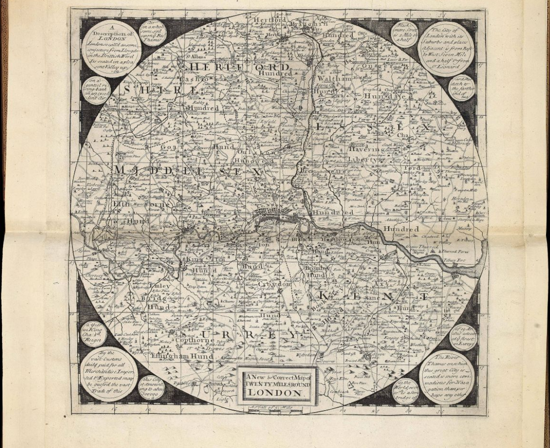
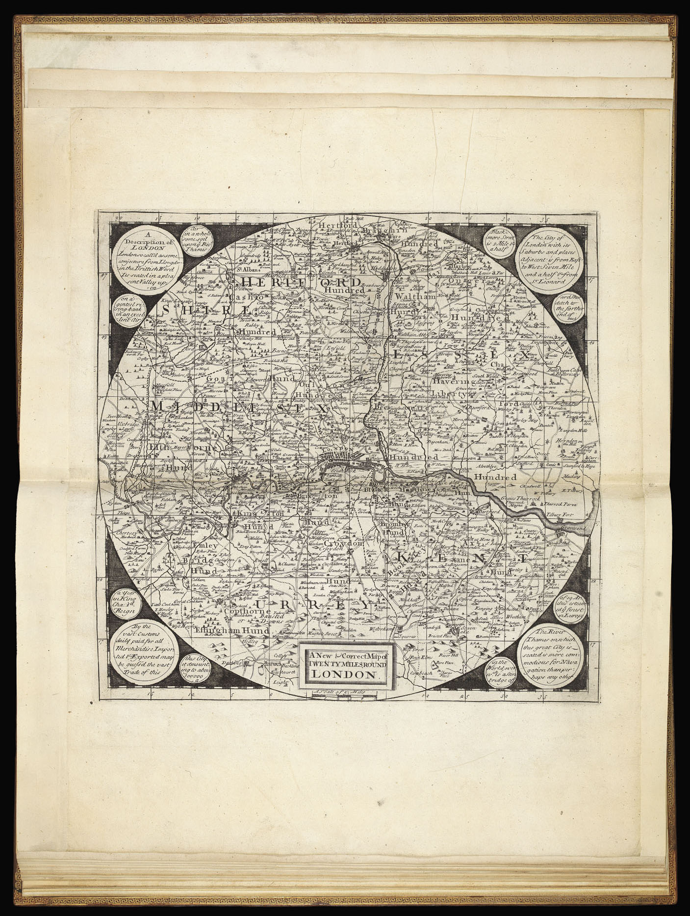
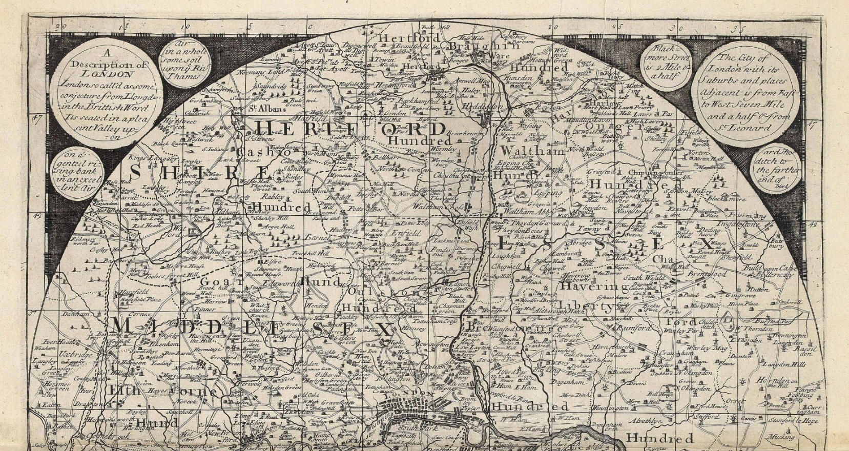
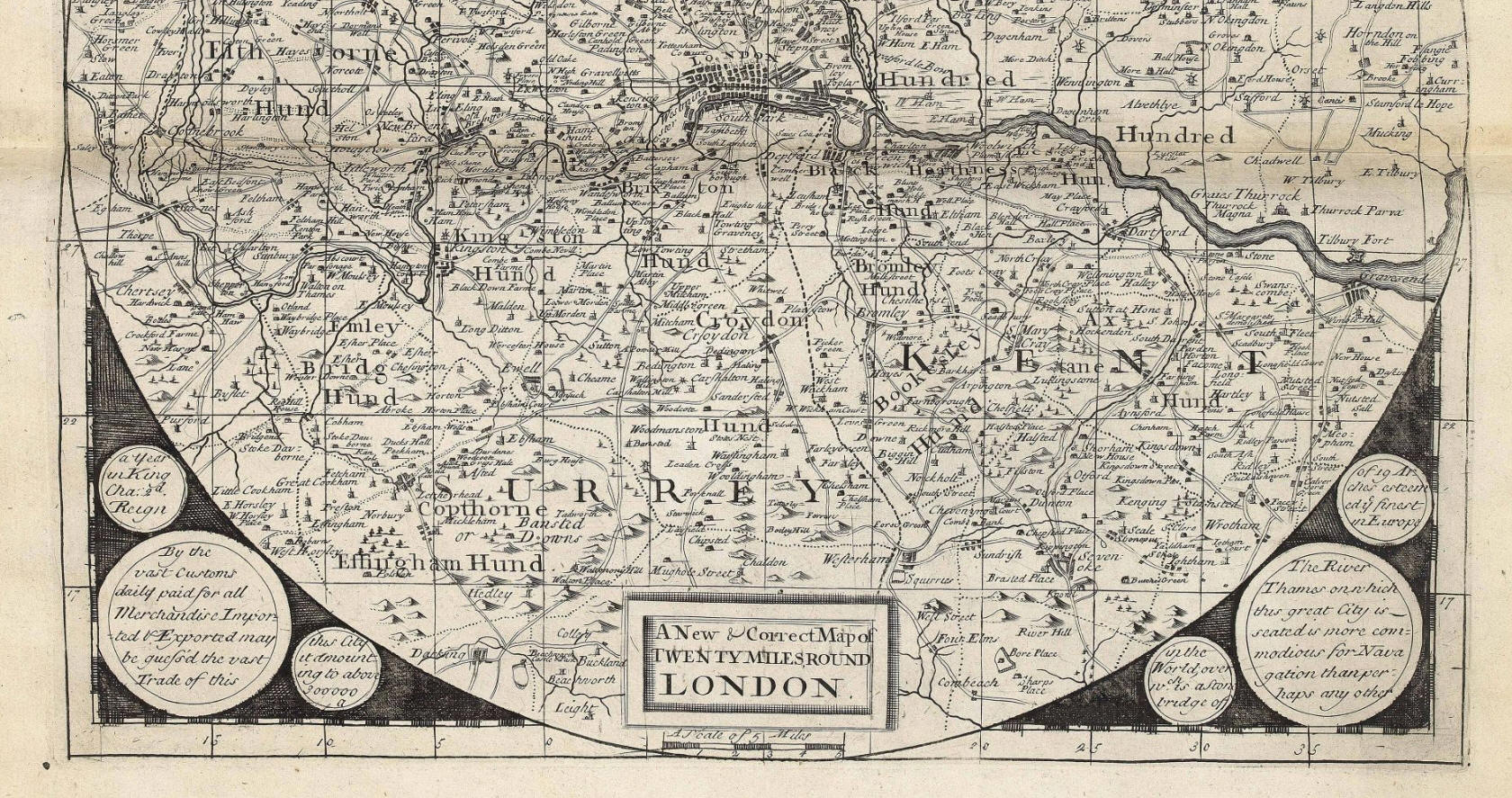
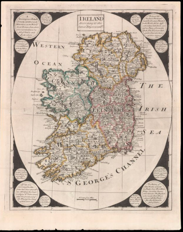
are a Northern Celestial Hemisphere, a Southern, ditto England, Scotland,
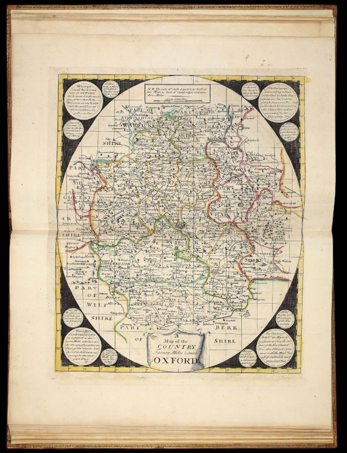
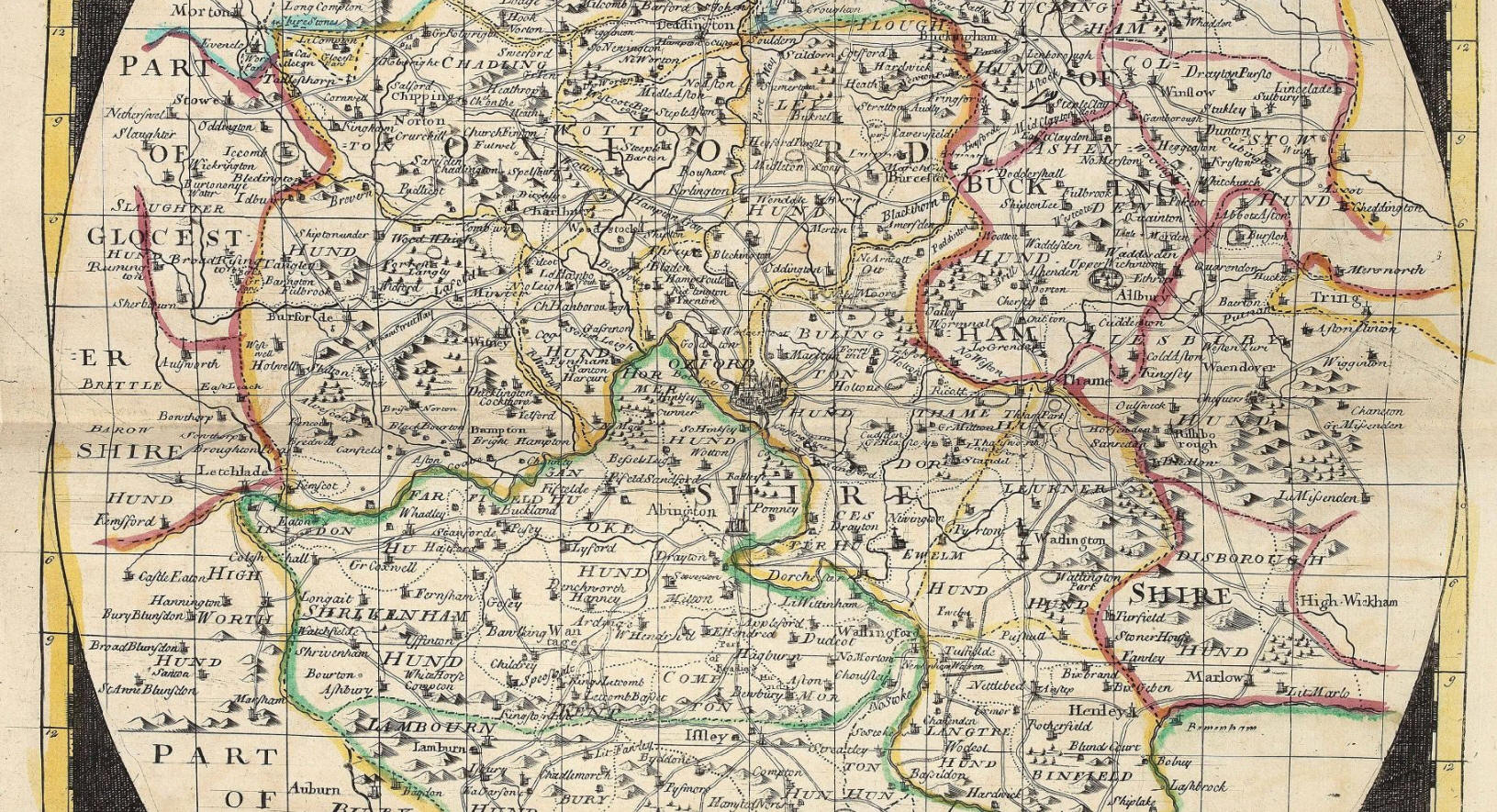
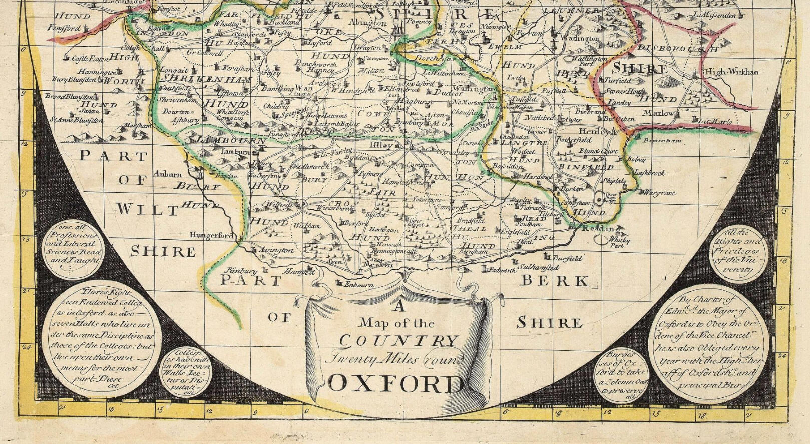
Ireland, 20 Miles round London, 20 Miles round Oxford, 20 Miles round Cambridge,
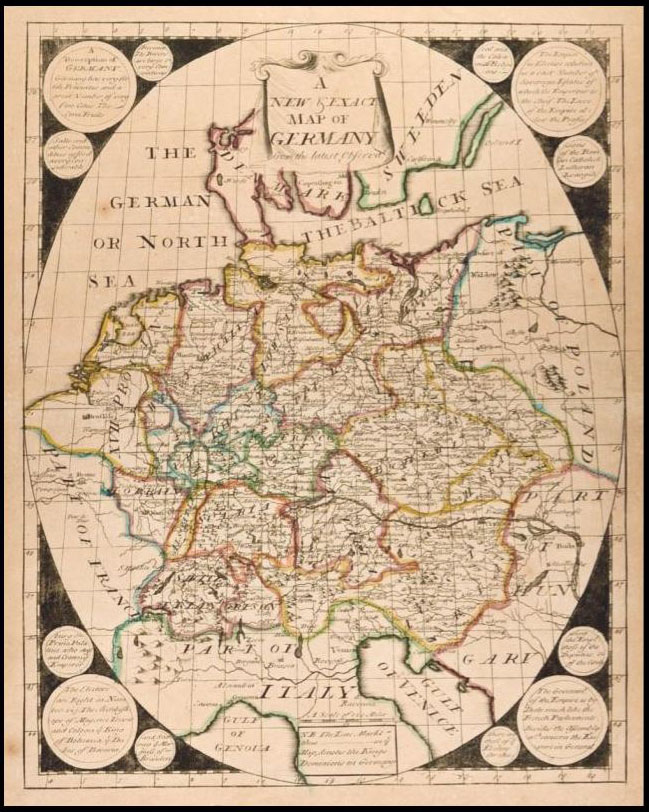
Germany, France, Spain, Italy, Sweedland, Poland, Denmark, Muscovy, Hungary, the
Turks Dominions in Europe, Flanders, and the Seven United Provinces. This Set of
Maps may be fitted up several ways and sizes, or bound in a Book, or Sold
single, to fit Gentlemens Conveniency; it is done by the Direction and Charge,
and Sold by George Willdey…“
Clearly, the customer in question chose to have the maps bound into an atlas
rather than pasted together, adding a map of the electorate of
Brunswick-Lunsberg, the ancestral holdings of the Hanoverian dynasty of British
monarchs. There was substantial British interest in the European territories of
their rulers.
Two maps are signed by Samuel Parker (b.1695, fl.1718–1728), draughtsman and
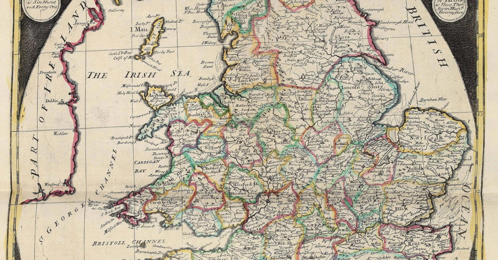
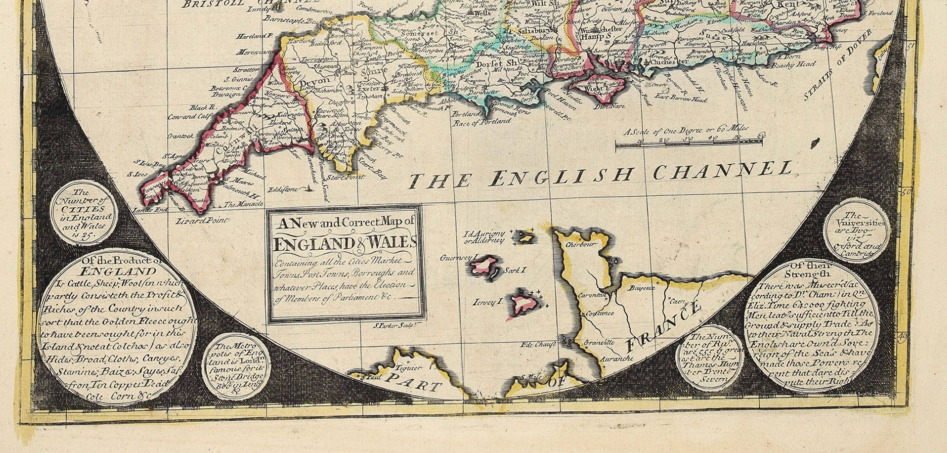
engraver. At least three of the maps — the southern hemisphere, England and
Wales, and Sweden and Norway — can be attributed to him, and given the
similarity of the others in style it is probable that he engraved them as well (Worms
and Baynton-Williams).
To find the maps together as an atlas is rare. Shirley notes a composite atlas
held by the British Library containing 19 of the 21 maps in the present example.
In the British Library copy, the map of Sweden and Norway is dated c1790 and
signed by James Barlow, indicating that the Library copy is dated later than the
present example, which appears to have been compiled at the time of the advert.
The British Library also holds an example of later states of the maps, printed
by Thomas Jefferys, made up into a screen.
George Willdey (?1671–1737) was a flamboyant London shopkeeper and
self-publicist. His principal business was as a toy-man and seller of luxury
goods, jewellery, gold and silver trinkets, and china. However, he was perhaps
the first mapseller to widen the appeal of maps from an intellectual elite to
the general public; adverts like the one above show his attempts to broaden
their appeal.
Bibliography
Shirley, T‑Anon 3a Hide info
Shirley, Rodney. (2004). Maps in the Atlases of the British Library: A descriptive catalogue cAD850 to 1800. London: British Library. 2 vols.
Worms, Laurence and Baynton-Williams, Ashley, British Map Engravers, (London: Rare Book Society, 2011). Hide info
Worms, L. and Baynton-Williams, A. (2011). British map engravers. London: Rare Book Society.
Di George Willdey
Leggi anche
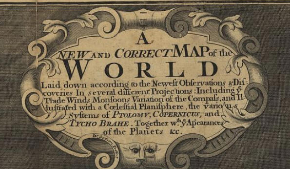
A new and Correct Map of the World, London 1702
http://www.atlascoelestis.com/Wildey%201702%20base.htm
S: Coelestial Hemisphere
da James Barlow
N: Coelestial Hemisphere
da James Barlow
Alcune altre tavole di
Composite Atlas, London 1721
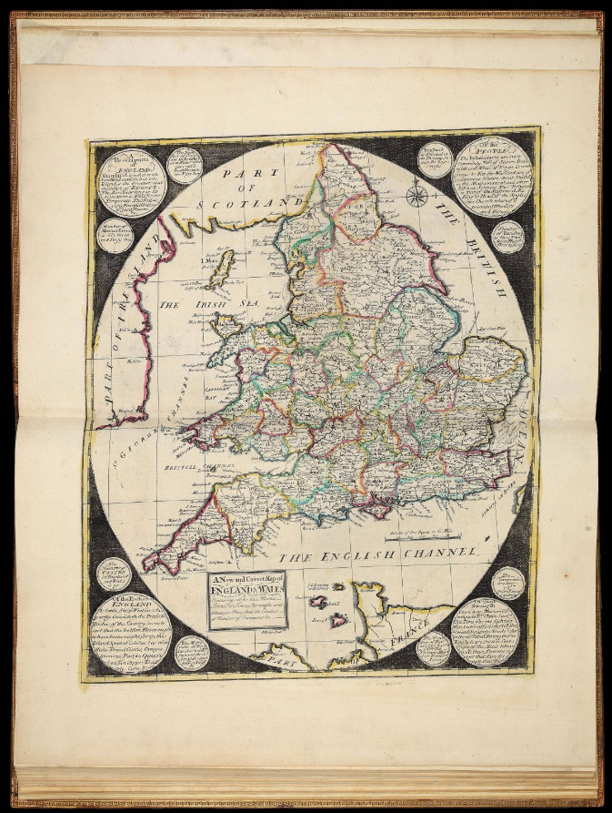
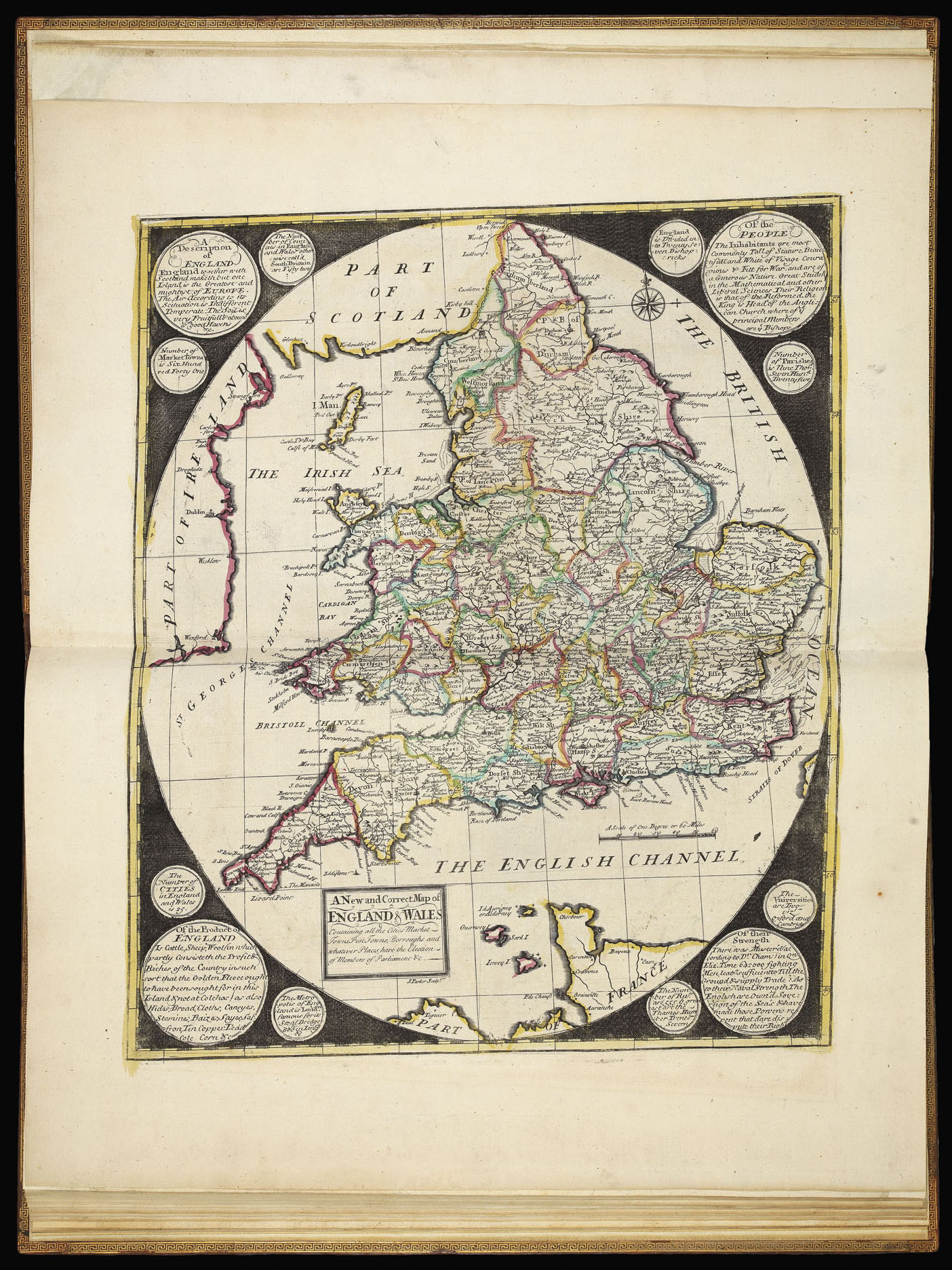
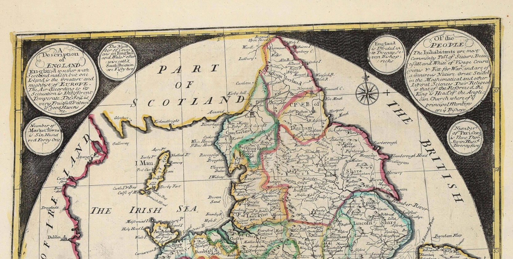
Sempre per cortesia di
Daniel Crouch Rare Books
pubblico una scheda biografica di
George Willdey (?1676–1737)
https://www.crouchrarebooks.com/discover/mapmakers/willdey-george
George Willdey was apprenticed in the Spectaclemakers’ Company to John Yarwell and Ralph Sterrop in 1695, and made free in 1702. After being freed, Willdey continued to work for Yarwell and Stirrop, but set up his own business in partnership with a fellow apprentice Timothy Brandreth in early 1707.
Willdey was one of the first in England to appreciate the use of newspapers for promotion and marketing, even if his notices were prone to hyperbole and self-aggrandisement. His earliest announcements claimed that he was making better telescopes than his former masters, and that he was supplying their instruments, which sparked a long-running, inconclusive and bitter controversy in the papers.
Willdey became an established shopkeeper, from prestigious premises close to St. Paul’s Cathedral, describing himself as a “toy-maker”, dealing in trinkets, gold and jewellery, plates, cutlery and china, toiletries, medicines and elixirs, snuff, fabrics, other curiosity items, as well as optical instruments, such as telescopes and reading glasses, and paintings. Samples of his stock are often depicted in advertisement boxes inserted on his maps.
From about 1709, Willdey gradually began to offer maps, in association with Charles Price sr. and John Senex, who were working on an atlas of two-sheet maps. Price and Senex’s partnership ended in 1710; Senex went off on his own, while Price was employed by Willdey to continue the project, adding new plates to those he retained when the partnership ended.
Price and Willdey went their separate ways in 1713. At first Willdey tried to offload the stock of maps at discounted prices, but over the next few years commissioned sufficient plates to produce an atlas, several of these supplied by the young Emanuel Bowen. Surprisingly, however, Willdey never offered the maps as an atlas, but only as loose sheets, and this may well account for the relative rarity of Willdey atlases.
In 1721, Willdey published a six-sheet wall map of the world and a series of roundel maps of Europe engraved by Samuel Parker; again, the roundel world maps were not advertised as an atlas (although they have been found in composite atlases); they seem to have been principally intended to make up a map-screen with the world map. The recorded extant examples of the wall map are all founded mounted on screens.
In 1732, Willdey was able to purchase a substantial proportion of the map stock of Philip Lea at the sale of Anne Lea’s materials in 1732; however, much of this was Lea’s older stock: the map plates for Christopher Saxton’s county atlas of England and Wales, first published in 1579 and Lea’s various regional maps of the Americas, published in the 1680s. The more up-to-date (and therefore more valuable) county maps and regional maps seem to have been acquired by Thomas Bowles (II) and his brother John, as being a more appropriate supplement to their stock.
Willdey died in 1737; his son Thomas, who had previously been deemed unsuitable, continued the business until his death in 1748. He was content to exploit his father’s material, but did purchase the printing plates for Henry Popple’s important wall map of North America. Following Willdey’s death, the printing plates passed to Thomas Jefferys sr., while others were reprinted by Cluer Dicey (notably the Saxton county maps) and his heir Richard Marshall, while the “toy-shop” was continued by his shop manager Susannah Passavant.
Willdey’s very successful business is detailed in court papers drawn up in a dispute over his will; maps accounted for less than 10% of his estate, which totalled some £9,000.
di FELICE STOPPA
GIUGNO 2021