|
Gerard De Jode |
Universi Orbis seu Terreni Globi in Plano Effigies. Cum privegio. Antwerp: G. Smits, 1578
|
Gerard De Jode
Universi Orbis seu Terreni Globi in Plano Effigies. Cum privegio. Antwerp: G. Smits, 1578
Fine original colour. 335 x 520mm.
Per cortesia di

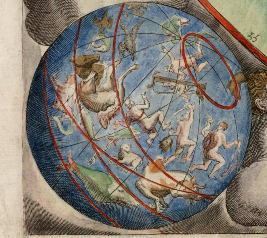
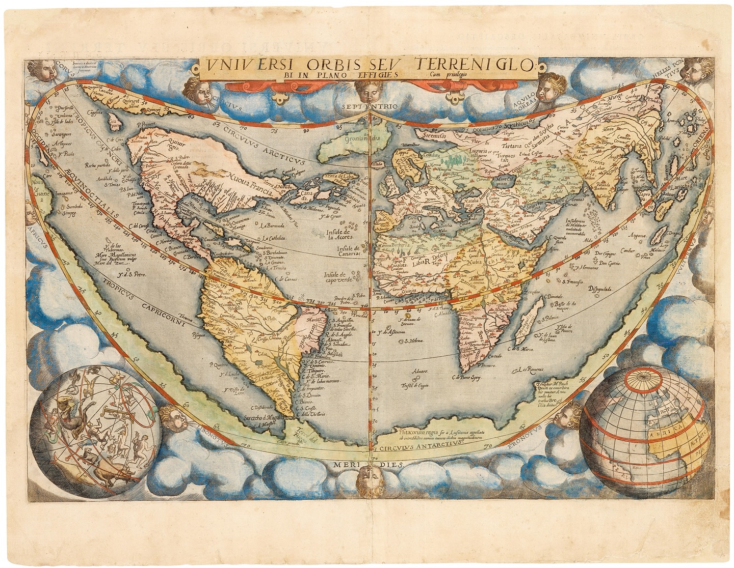
An important and rare map of the world, engraved by brothers Jan and Lucas van Doetecum inspired by Abraham Ortelius’s eight-sheet map of 1564. It uses a cordiform (heart-shaped) projection, with wind-heads around the map and terrestrial and celestial spheres in the bottom corners. On the map above North America. a ‘north-west passage’ connects the Atlantic and Pacific Oceans, running outside the Arctic Circle, with Japan at the Pacific end. The Great Southern Continent follows the southern border of the map.
The map was ready for publication in 1571, but De Jode could not get a license to publish his atlas, apparently because of interference by Ortelius, who wanted to protect his own 10-year privilege for the ‘Theatrum’. It was only in 1578 that the ‘Speculum Orbis Terrarum’ was issued, by which time the title of this map had been altered, removing Ortelius’s name as the source.
This map only appeared in the first edition of the atlas: the second, expanded edition of 1593, published by Gerard’s widow and sons, contained two new world maps, on Mercator’s Projection and a polar double-hemisphere.
Neither edition of the ‘Speculum’ sold well, as Ortelius’s ‘Theatrum’ already dominated the market. The second edition was to be the last: after 1600 the plates were bought by Jan Baptiste Vrients, who also acquired the Ortelius rights, to ensure they were never printed again. Thus all editions of the De Jode maps are scarce.
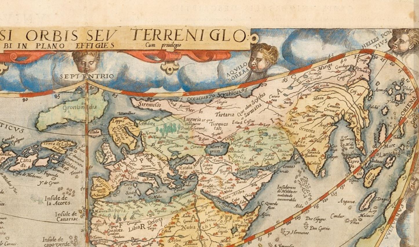
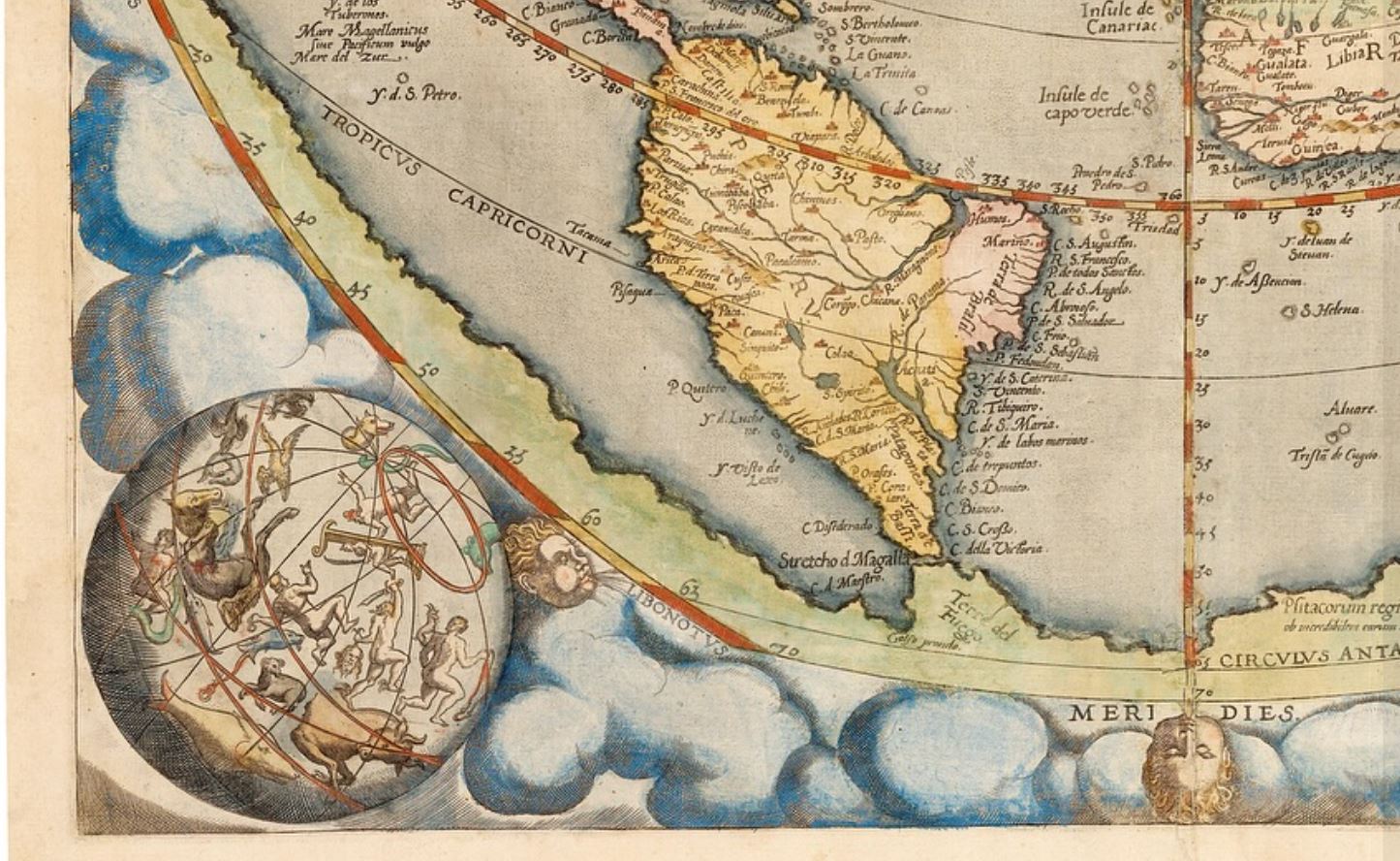
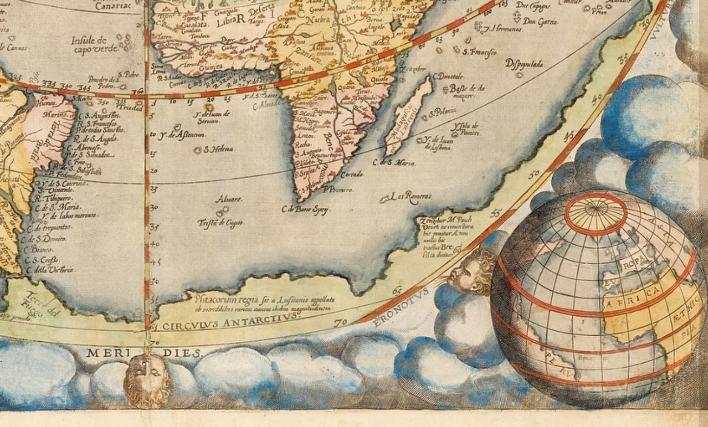
Un'importante e rara mappa del mondo, incisa dai fratelli Jan e Lucas van Doetecum, ispirata alla mappa in otto fogli di Abraham Ortelius del 1564. Utilizza una proiezione cordiforme (a forma di cuore), con venti che corrono lungo la mappa e sfere terrestri e celesti negli angoli inferiori. Sulla mappa sopra il Nord America, un "passaggio a nord-ovest" collega l'Oceano Atlantico e il Pacifico, correndo al di fuori del Circolo Polare Artico, con il Giappone all'estremità del Pacifico. I Grande Continente Australe segue il confine meridionale della mappa.
La mappa era pronta per la pubblicazione nel 1571, ma De Jode non riuscì a ottenere la licenza per pubblicare il suo atlante, apparentemente a causa dell'interferenza di Ortelius, che voleva proteggere il suo privilegio decennale sul "Theatrum".
Solo nel 1578 fu pubblicato lo "Speculum Orbis Terrarum", quando il titolo di questa mappa fu modificato, rimuovendo il nome di Ortelius come fonte. Questa mappa apparve solo nella prima edizione dell'atlante: la seconda edizione ampliata del 1593, pubblicata dalla vedova e dai figli di Gerardo, conteneva due nuove mappe del mondo, una basata sulla Proiezione di Mercatore e una con un doppio emisfero polare. Nessuna delle due edizioni dello "Speculum" vendette bene, poiché il "Theatrum" di Ortelius dominava già il mercato. La seconda edizione sarebbe stata l'ultima: dopo il 1600 le tavole furono acquistate da Jan Baptiste Vrients, che acquisì anche i diritti di Ortelius, per garantire che non venissero mai più stampate. Pertanto, tutte le edizioni delle mappe di De Jode sono rare.
di FELICE STOPPA
MAGGIO 2025