|
Ignace-Gaston Pardies, Thomas Gouye |
Globi Coelestis in Tabulis Planas Redacti Descriptio, Paris, 1690 |
Ignace-Gaston
Pardies
Globi Coelestis in Tabulis Planas Redacti Descriptio, Auctore P. Ignatio Gastone Pardies, Soc. Jesu Mathematico, Paris 1674
Il
gesuita francese I. G. Pardies ( 1636-1673), professore di matematica presso il College
de Louis-le-Grand di Parigi, pubblica in Francia nel 1674 la presente
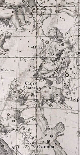
raccolta di sei mappe che hanno il pregio di rappresentare tutta la volta
celeste raccogliendo la posizione di 1481 stelle, tratte da cataloghi e rassegne
di Keplero, Bayer e Riccioli, la cui posizione è calcolata per il 1673. Vi
vengono raccolte 63 costellazioni: le 48 tolemaiche accompagnate da Columba,
Coma Berenices, Antinous, le dodici meridionali segnalate da Keyser et Houtman,
Lilium ( che appare per la prima volta in una mappa celeste identificando
alcune stelle informatae dell’Ariete tolemaico) e
Cruzero, le ultime due sono soltanto disegnate e non appaiono nell’elenco
che accompagna le mappe. Gli astri sono graduati e suddivisi in sei magnitudini,
vengono segnalate anche alcune nebulose e
diverse orbite di comete apparse tra il 1577 e il 1672 così come le seguenti Stelle
Novae:
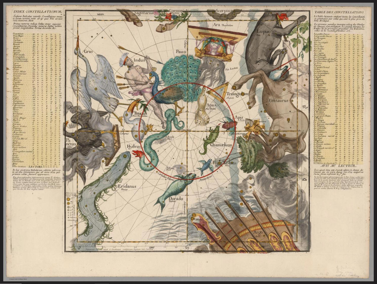
La
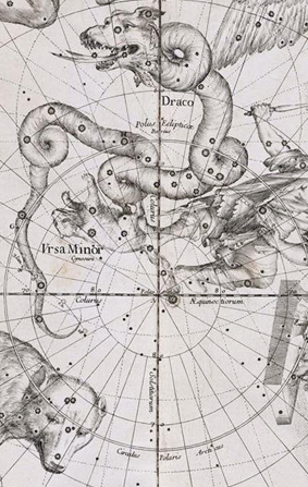
prima e l’ultima mappa sono dedicate ai due poli che vengono disegnati in
proiezione gnomonica fino alla latitudine di 45 gradi, rispettivamente Nord e
Sud. Il centro delle due mappe è occupato dai due poli equatoriali.
Le
altre quattro mappe che hanno per centro l'
incrocio tra i coluri e l’equatore celeste rispettivamente nel punto
equinoziale primaverile e autunnale e in quello solstiziale invernale ed estivo,
rappresentano la fascia di cielo a nord e sud della linea equatoriale per una
ampiezza di 45°N e 45° S di declinazione e di 90° di ascensione retta.
Le
mappe vere e proprie sono quadrate con lato di
Sulla vita e le opere di Pardies consulta il The General Biographical Dictionary di Alexander Chalmers, London 1815:
per cortesia di
![]()
Le tavole
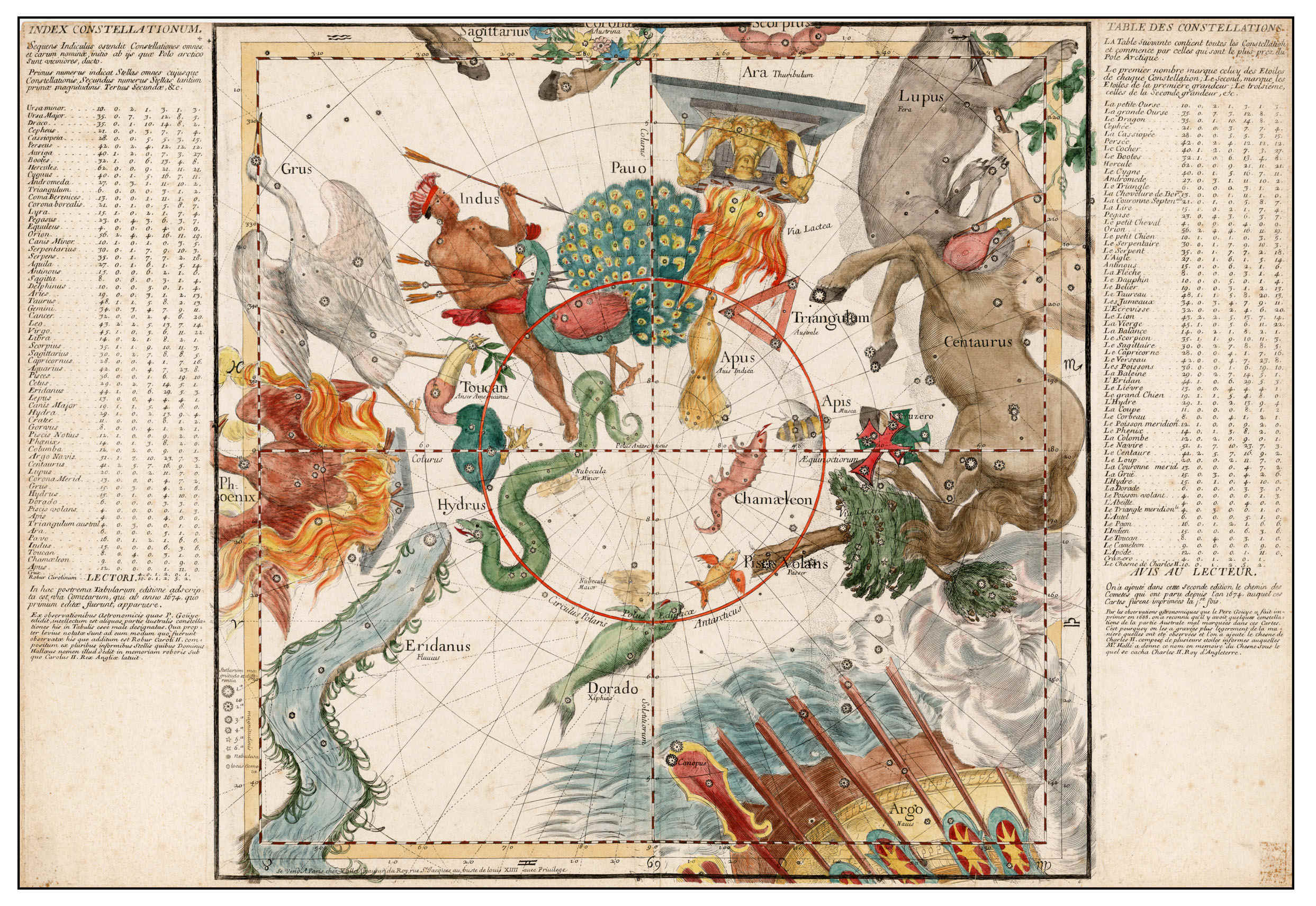
VI
Polo Antartico
Globi Coelestis in Tabulis Planas Redacti Descriptio, Auctore R. P. Ignatio Gastone Pardies, Societatis Jesu Mathematico, Opus Postumum. Seconde edition, Paris 1690
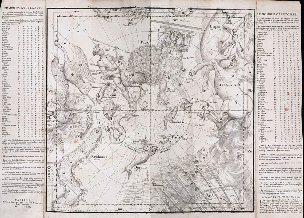
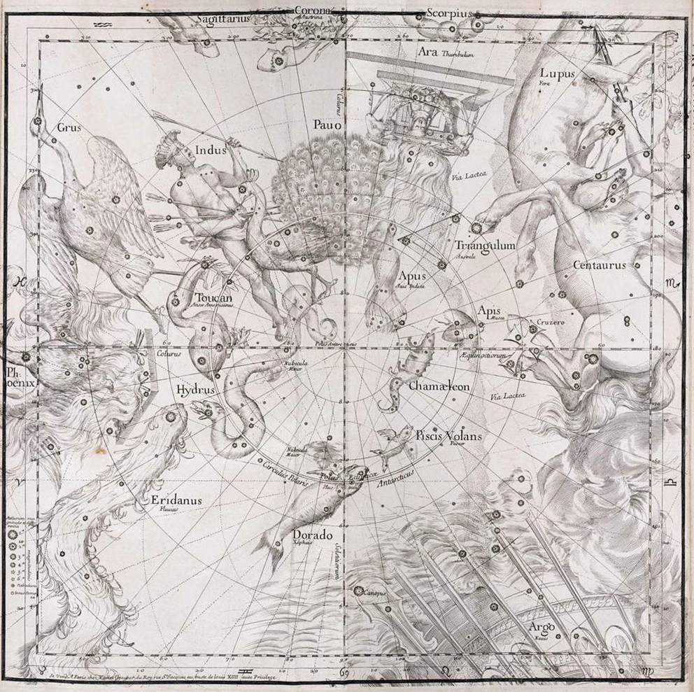
Tavola VI
L'atlante di Pardies vide una nuova edizione, sempre a Parigi , nel 1690. Di seguito riporto la Tavola VI dedicata al Polo Antartico messa gentilmente a disposizione da
![]()
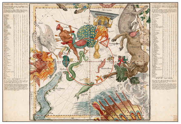
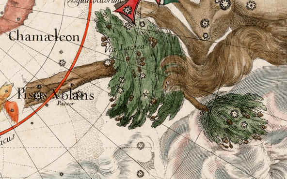
La nuova edizione, che viene redatta con l'apporto delle osservazioni di Thomas Gouye, ricalca l'edizione del 1674 migliorando la posizione delle stelle ed inserendo la nuova costellazione di Robur Carolinum. Nella colonna di testo a destra della tavola, in basso, si afferma di aver aggiunto il percorso delle comete apparse dopo il 1674. L'autore corregge inoltre la posizione di alcune stelle ridisegnandole nuovamente ma lasciandole anche nella posizione errata che avevano nella mappa del 1674, incise però con un carattere leggermente meno marcato. Abbiamo così la curiosità di vedere disegnate due volte molte stelle, ad esempio Canopo, ma anche l'intera costellazione del Cruzero.
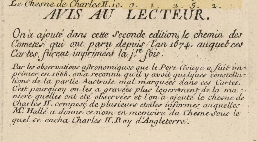
Avviso ai lettori
Robur Carolinum
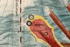
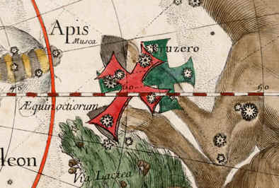
Canopus e Cruzero disegnate due volte
Tavola VI
Trascrivo di seguito la descrizione della tavola così come è riportata sul sito di Barry Lawrence Ruderman che la pone attualmente in vendita:
Title: [Celestial Map of the Southern Hemisphere]
Map Maker: Ignace Gaston Pardies
|
Place / Date: Paris / 1690 |
Coloring: Hand Colored |
|
Size: 28 x 19 inches |
Condition: VG |
|
Price: $3,400.00 |
Inventory ID: 33613 |
Description:
Fine fully colored example of this rare 17th Century map of the Southern Celestial Hemisphere, originally issued in 1674 by Ignace Gastone Pardies in Paris and revised in 1690, based in part on the work of the French Jesuit mathematician and astronomer Thomas Gouye (1650-1725).
The map first appeared in Globi Coelestis in Tabulas Planas Redacti descriptio ... opus postumum, by Ignace Gaston Pardies and edited by Jan De Fontenay, in 1674. Dedicated to Johan Friedrich, Duke of Braunschweig-Luneburg and engraved by G. Vallet in Paris, the atlas consisted of 6 Celestial Charts with text in Latin and French at the sides. Pardies (1636-1673) was a Jesuit astronomer whose manuscript star atlas was published by his colleagues just after his death.
Pardies atlas was then reissued in 1690, with new information added, including the paths of comets observed since 1674 and corrections attributed to Thomas Gouye, described below. The figures of the Constellations are drawn from Bayer's Uranometria, with the figures carefully reworked and adapted to a broader view of the sky than was originally presented by Bayer.
The present example of the map appeared in the 1690 edition of Globi Coelestis in Tabulas Planas Redacti descriptio, and can be distinguished from the map included first edition of the atlas by the revisions attributed in the text panels to Gouyeand from the third edition of the atlas, published in 1693, which includes a different engrafer credit at the bottom left margin (apud G. Duchange), as illustrated by the copy of the map in the National Library of France: gallica.bnf.fr/ark:/12148/btv1b59714416/f6.item
This magnificent work is perhaps most recognizable as the source of inspiration for the hemispheric projections of Gabriel Doppelmayr, which first appeared in the 1730s in atlases by Johann Baptist Homann and later appeared in Doppelmayr's Atlas Coelestis, first published in 1742.
The map provides a remarkable depiction of the Southern Sky (an internal view of the southern hemisphere centered on the southern equatorial pole in a gnomonic projection). The second edition of the map was apparently revised to include the work of later Jesuit scholars, including Thomas Gouye, a French Jesuit astronomer and mathematician, working in Dieppe.
Gouye's Observations Physiques et Mathematiques . . . published in 1688 in Paris, was an important scientific work published by the Jesuits, which included critical observations and corrections of some of his predecessors. With respect to its Astronomical observations, it is noteworthy for being a true work of science, rather than a travelogue, compiling astronomical observations, instrumentation, and weather conditions, in addition to observed astronomical positions and related calculations.
In the marginal notes below the Astronomical Index, the text notes Gouye's correction of the observations of Guy Tachard (1651-1712), who made a number of important celestial observations in the Southern Hemisphere, during his embassy to Siam in 1685, which were published in his Voyage de Siam des Peres Jesuites . . . (Paris, 1686). Gouye used his treatise to recalculate the determinations of latituded made by Tachard, uisng more recent and more accurate declination tables drawn by Philippe de La Hire.
All editions of Pardies Atlas are rare. We note 2 examples of the 1674 edition offered in the past 30 years, with no recorded examples of the 1690 edition appearing on the market in more than 50 years.
Le tavole dell'atlante di Pardies nell'edizione del 1693 per cortesia di

Tavola I
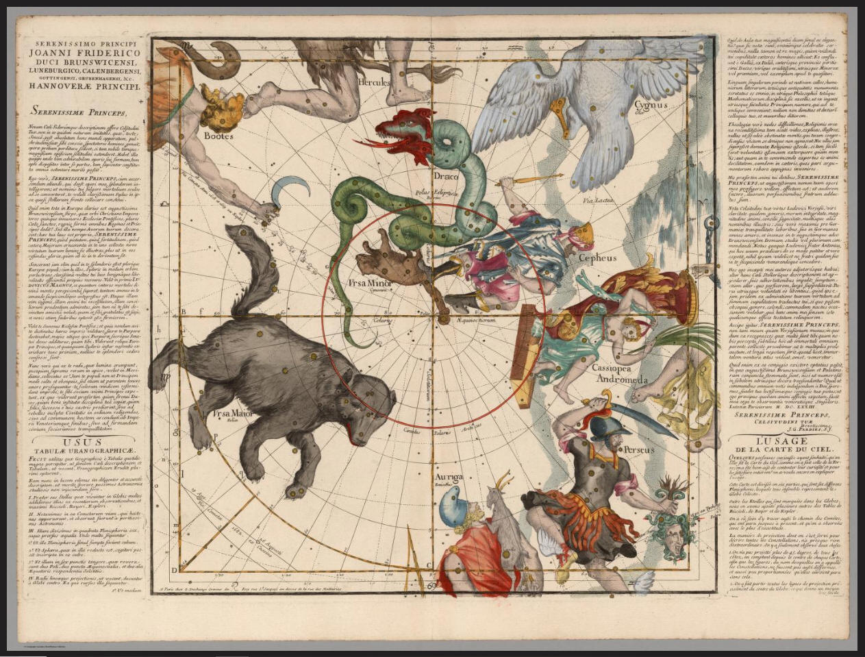
Tavola II
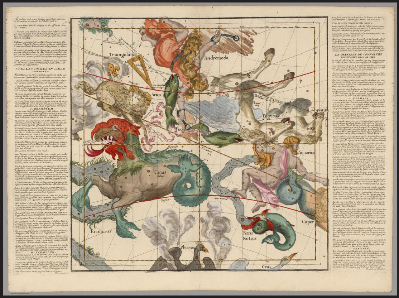
Tavola III
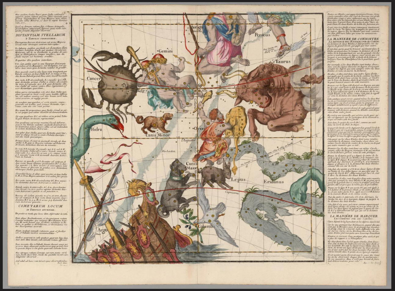
Tavola IV
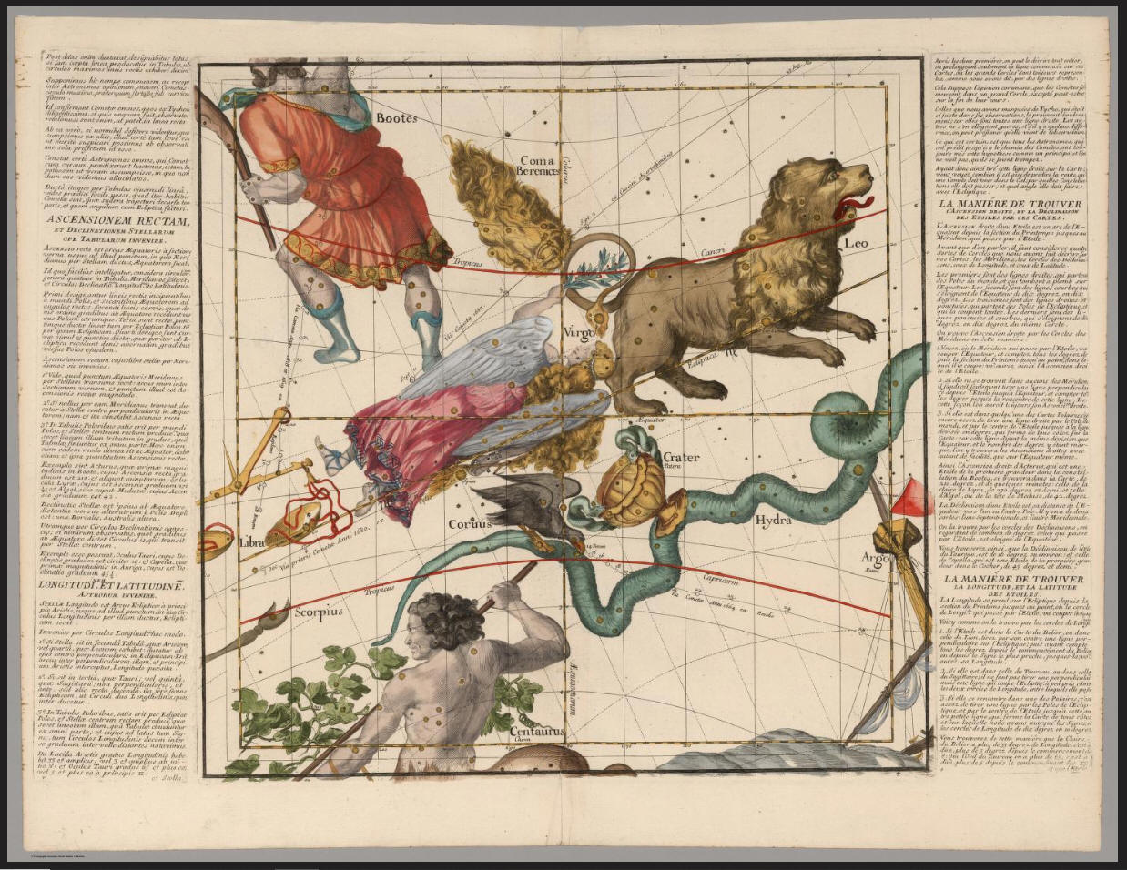
Tavola V
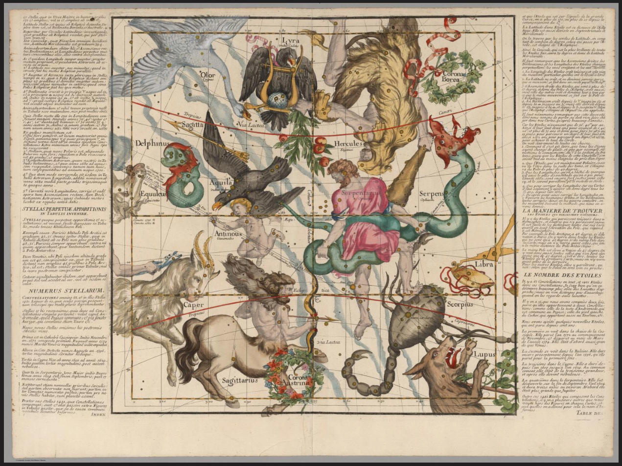
Tavola VI
Vedi altre edizioni in

https://gallica.bnf.fr/ark:/12148/btv1b59714416
https://catalogue.bnf.fr/ark:/12148/cb406184551
Costruisci il globo di Pardies

Pardies Celestial Globe (Christmas Ball).pdf
per cortesia di
Giuseppe (Pino) Civitarese
Aprile 2013
di
FELICE STOPPA