|
Luis Teixeira, Joshua van den Ende |
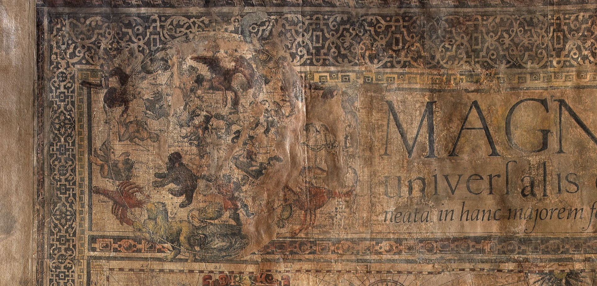
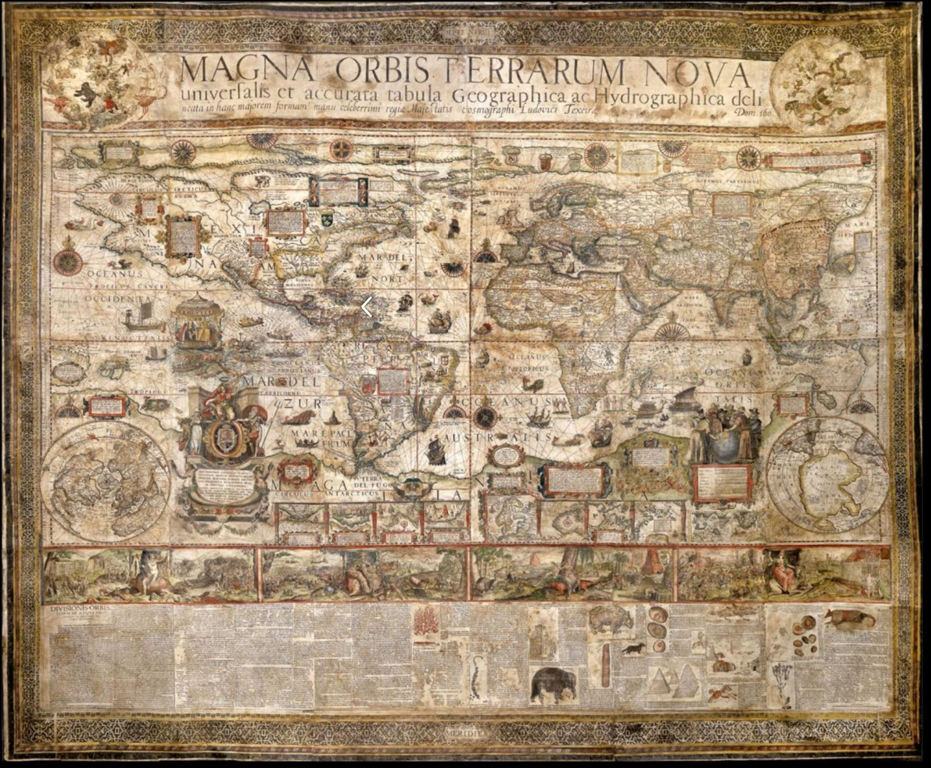
Magna Orbis Terrarum Nova universalis et accurata tabula Geographica ac Hydrographica delineata in hanc majorem formam manu celeberrimi regiae Majestatis cosmographi Ludovici Texeirae, Antwerpiae 1604
|
Luis Teixeira
Joshua van den Ende
Magna Orbis Terrarum Nova universalis et accurata tabula Geographica ac Hydrographica delineata in hanc majorem formam manu celeberrimi regiae Majestatis cosmographi Ludovici Texeirae, Antwerpiae 1604
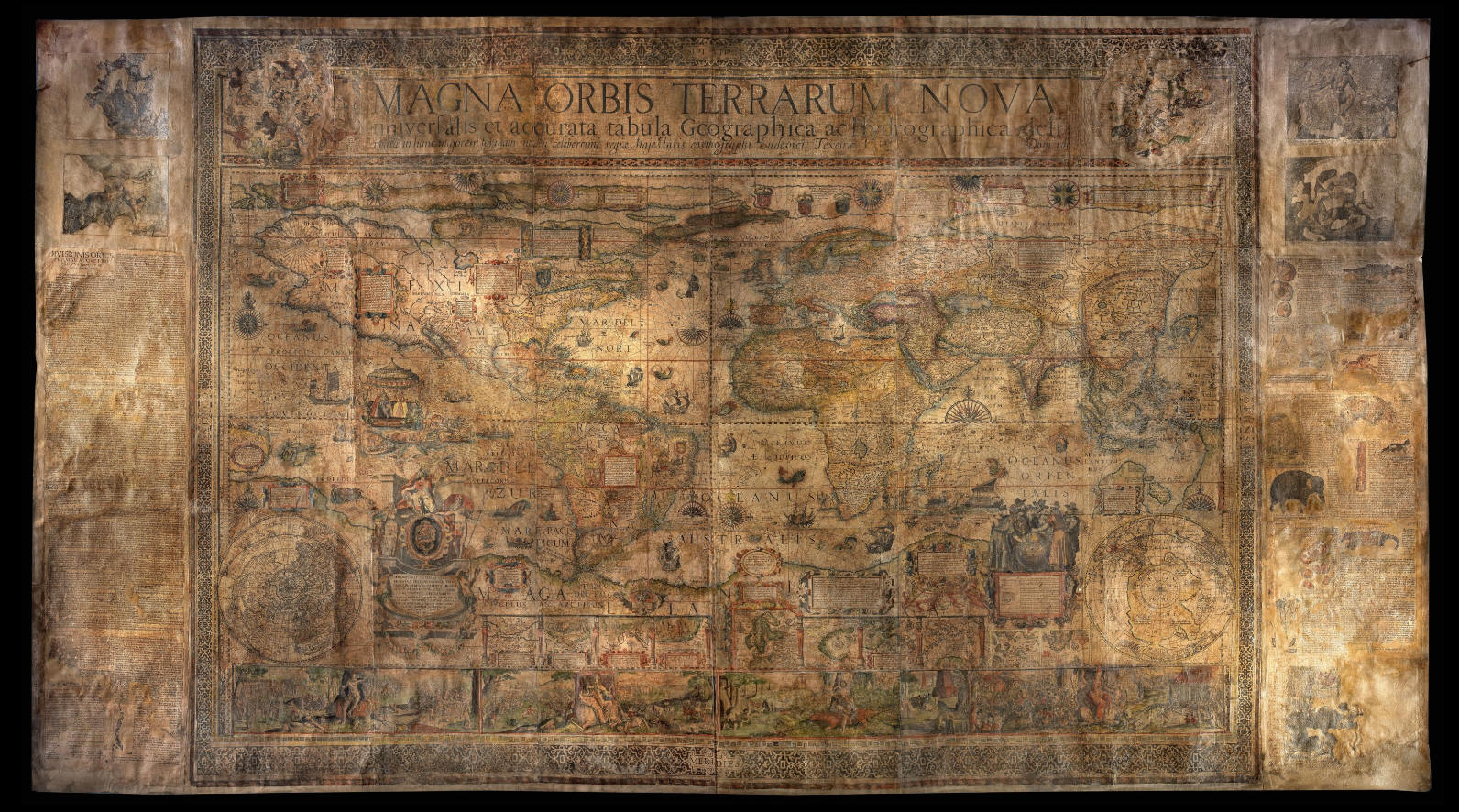
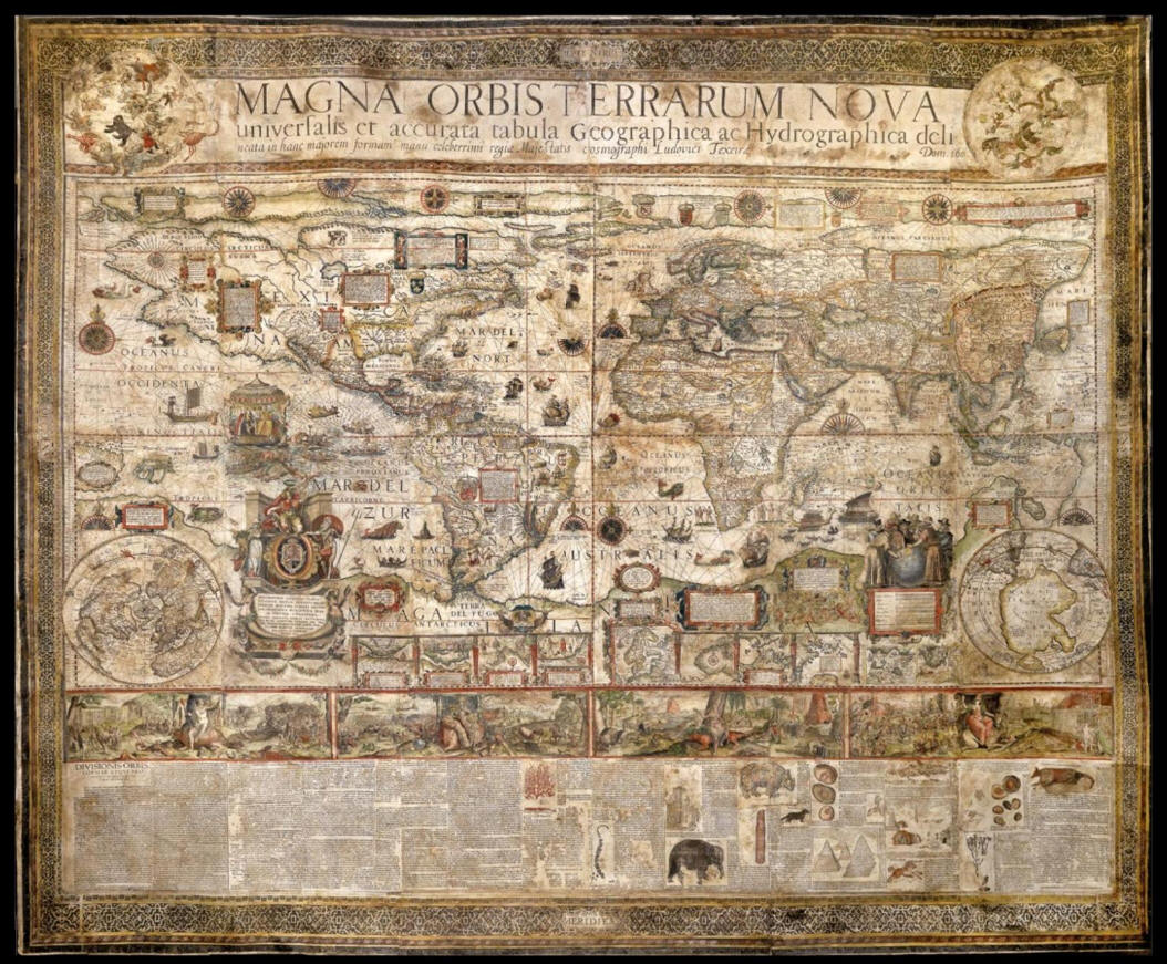
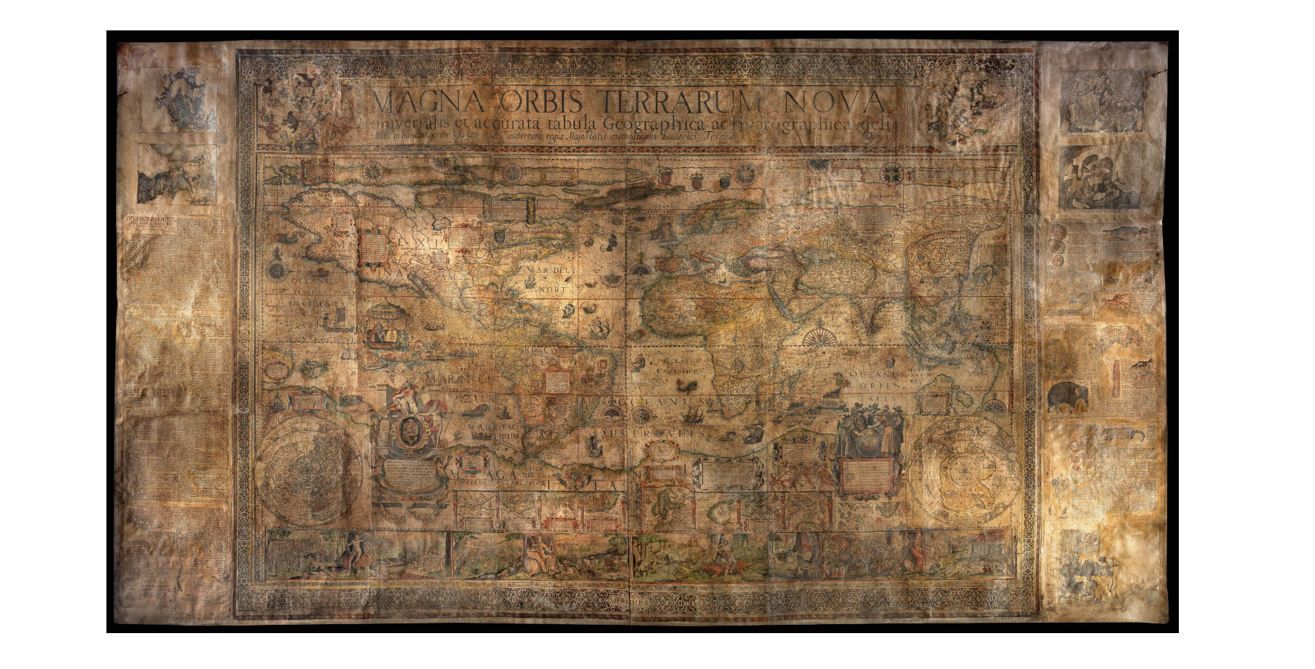
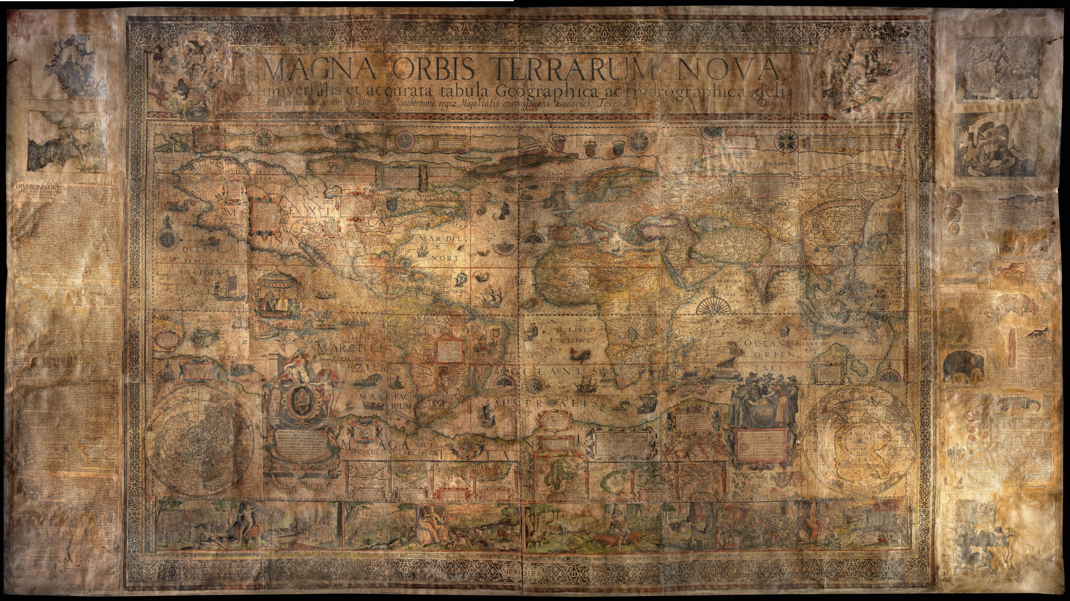
La grande e rarissima tavola realizzata da Luis Teixeira in due formati che si distinguono soltanto per la composizione delle parti annesse e per il formato, 167 cm per 297 e 113 cm 231, incisa da Joshua van den Ende e venduta sia da Jean Baptiste Vrients che da Cornelius Claesz, è riconosciuta come un aggiornamento operato dal suo autore della tavola prodotta nel 1592 da Petrus Plancius con il contributo di Johannes Baptista Vrient ed incisa da Jan van Doetecum con il figlio Baptista il cui unico esemplare esistente conosciuto oggi appartiene al Collegio del Corpus Cristi di Valencia in Spagna.
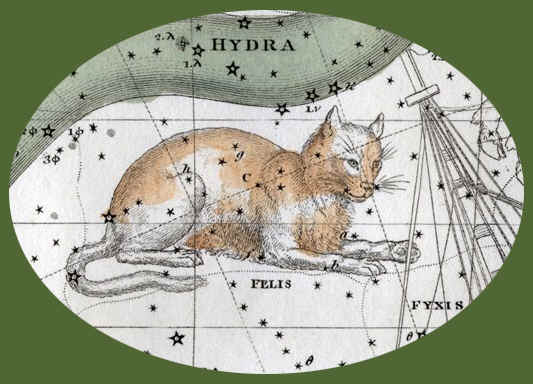
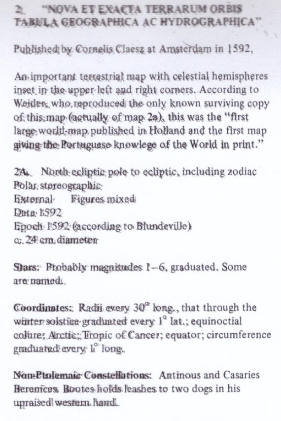
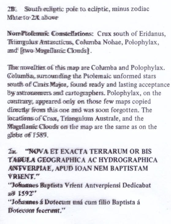
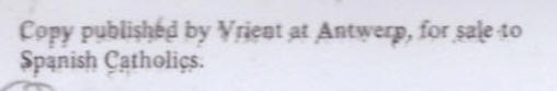
Rif: Deborah J. Warner, The Sky explored, Celestial Cartograhy 1500-1800, Pagina 202, punto 2, 2A, 2B, 2a " Nova et exacta terrarum orbis tabula geographica ac hydrographica" e “ Nova et exacta terrarum orbis tabula geographica ac hydrographica Antverpiae, apud Joan nem Baptistam Vrient”, New York - Amsterdam 1979
http://www.atlascoelestis.com/plan%201589-1649.htm
Di seguito riproduco le immagini delle due copie della tavola di Luis Teixeira e delle due attente presentazioni che le precedono per cortesia di Daniel Crouch Rare Book che recentemente le ha proposte in vendita

https://issuu.com/danielcrouchrarebooks/docs/catix
Prima tavola
Author:
TEIXEIRA, Luis
Magna Orbis Terrarum Nova universalis et accurata tabula Geographica ac Hydrographica delineata in hanc majorem formam manu celeberrimi regiae Majestatis cosmographi Ludovici Texeirae, Antwerpiae 1604
Dedication:
Serenissimae Isabellae Clarae Eugeniae Hispan. Infanti. Belg. Principi, Sereniss. Alberti Archid Austriae Ducis Burgindiae Brab. &c. Coniugi Charissimae: Joannes Baptista Vrints Antwerpiae nus, hanc Ludovici Tesseirae Cosmographi Hispaniarum Regum Longae Peritissimi Mappam Generalem D.D. Anno à Christo Nato 1604.
Publication place:
Antwerpiae
Publisher:
apud Joannem Baptistam Vrient
Publication date:
1604
Physical description:
Engraved map, printed on twelve sheets, flanked by four sheet letterpress description annotated with several woodcut animals, with fine contemporary hand-colour heightened gold, trimmed to neat lines, laid on linen, extensive areas of restoration. A full conservation report is available on request.
Dimensions:
1670 by 2970mm. (65.75 by 117 inches).
To scale:

Notes
A spectacular wall map of astonishing beauty made at the beginning of the Dutch Golden Age.
Cartography
The present map draws on the cartography of Luis Teixeira (fl 1564–1613), whose
name appears in the large pasted title — a Portuguese cartographer from a famous
mapmaking dynasty. He worked in Lisbon and the Portuguese colonies, but was also
a friend of and collaborator with Dutch cartographers, contributing a map of
Japan to Abraham Ortelius’s atlas. Ortelius and Cornelis Claesz published five
of his maps between them, and all were specifically advertised as based on his
work, indicating that he was highly respected in Amsterdam.
The map is based upon a simple cylindrical projection and follows very closely
the 1592 wall map drawn by Petrus Plancius, “a milestone in the emergence of Dutch cartography [and] the first
large wall map of the world to be published in the north” (Schilder). The work
was engraved by Baptista and Jan van Doetecum and is known only in a single
extant example: that in the Colegio del Corpus Cristi in Valencia, Spain.
Plancius drew heavily on Mercator’s 1569 world map, as well as contemporary
manuscript maps by the Portuguese cartographers Pedro de Lemos and Bartolomeo de
Lasso. The present Teixeira map shows a number of significant improvements over
Plancius’s prototype: the redrawing of Guiana following Sir Walter Raleigh’s
exploration of 1595; the insertion of the Davis Strait, Novaya Zemblya, and the
tributaries of the Congo; and amendments to the southern parts of South America
and Africa.
This updated geographical information was derived from accounts of voyages
collected by Linschoten, De Bry, Hulsius, Claesz and others.
The map is noteworthy for its portrayal of a vast southern continent, and its
depiction of the Southern Pacific at the dawn of Dutch exploration of southeast
Asia and Australasia. The true form of the island of New Guinea had not yet been
ascertained, and so, bizarrely, it appears twice: once as an island on the left
hand side of the map, and again as part of the mythical continent of Magellanica
on the right. The Gulf of Carpentaria is tantalizingly hinted at in the sweeping
bay in Magellanica at the far right of the map.
The myth of the Great Southern Continent was propagated by the belief that, in
order to balance the earth, there must be a landmass in the southern hemisphere
of a size commensurate with that in the north. It was, in part, this erroneous
assumption that spurred Dutch exploration of Australia in the seventeenth
century, and Captain Cook’s voyages over one hundred years later. It was not
until the twentieth century, and the explorations of Captain Scott and Roald
Amundsen, that the lands of the southern hemisphere were finally charted with
any degree of accuracy.
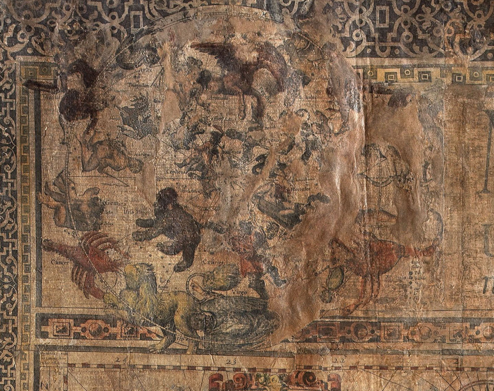
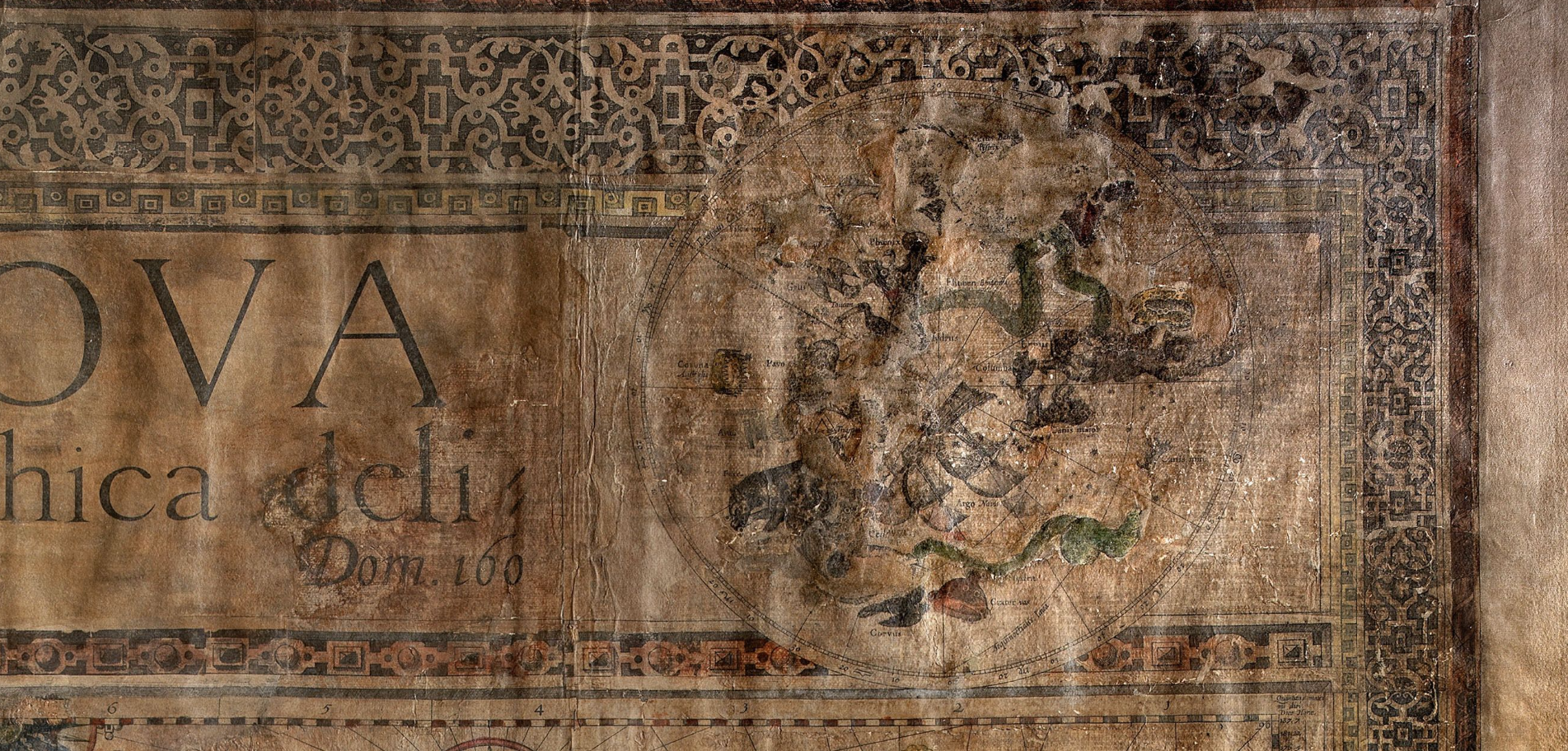
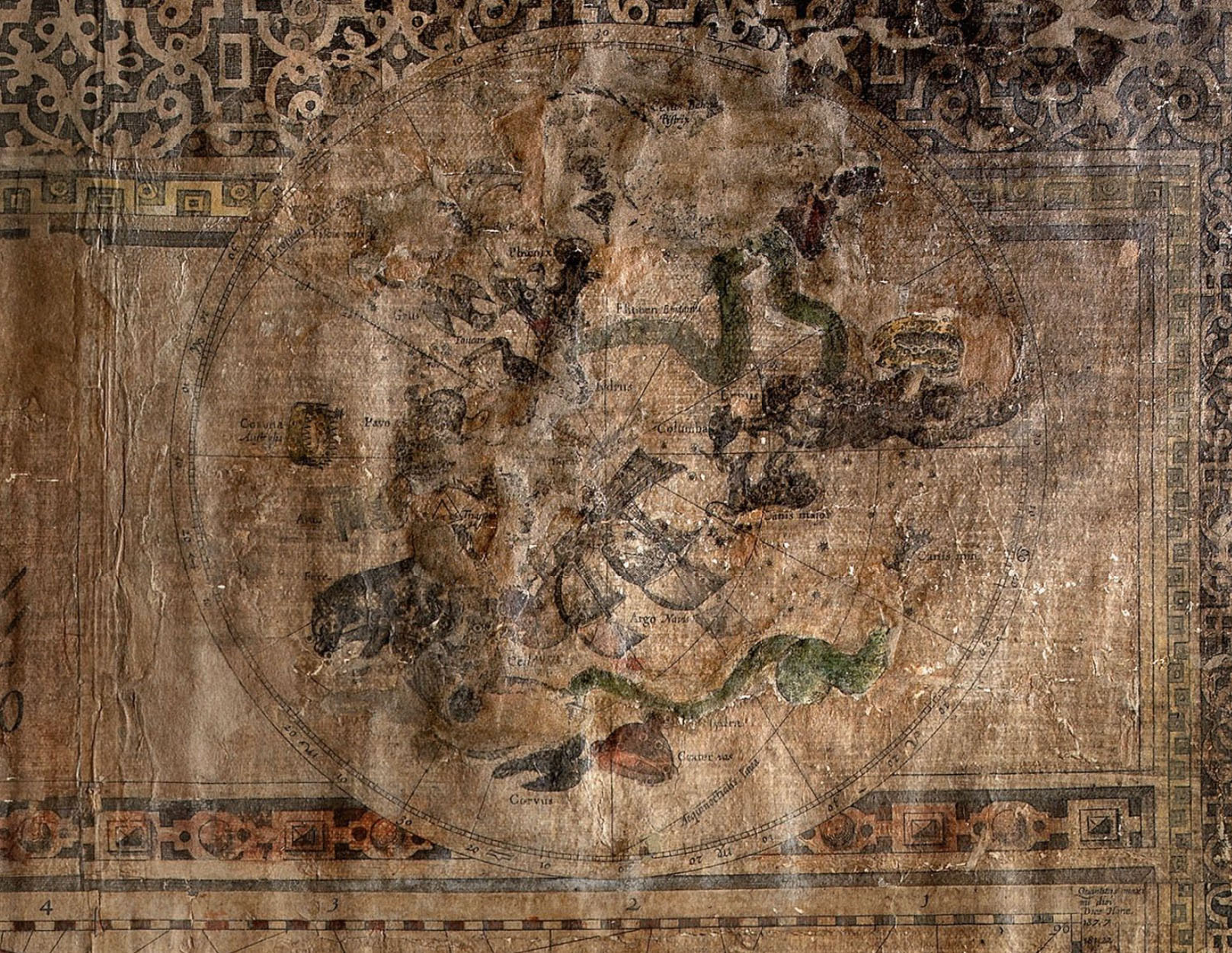
Towards the lower corners of the map are representations of the northern and
southern hemispheres, and along the bottom of the map are ten small panels
containing detailed maps of Magellan’s Strait (according to Drake in 1579, Noort
in 1599, and De Weert, also in 1599); of Rio de la Plata; Northern Europe;
Novaya Zemlya (according to Barentsz in 1598), and the straits of Sona (off
Java); Anian; Manilla; and Gibraltar. Below the map, printed on separate strips,
are long engraved panels presenting the four continents, each personified by a
woman riding a symbolic mount. Background scenes show the typical architecture
or dwellings of each region, indigenous animals, and the local peoples engaged
in battle. These scenes relate to the text panels flanking the map, which are
printed in letterpress interspersed with depictions of local flora and fauna.
This text is trimmed from the only known institutional example of this map,
making the present example, together with a further privately held copy, one of
only two known maps surviving in its original form.
Publication
The existence of an extremely large wall map of the world by Luis Teixeira, sold
by Jean Baptiste Vrients and Cornelis Claesz, is recorded by Schilder in ‘Wall
Maps of the World published in Amsterdam before 1619’ (MCN, vol. III, p. 39 No.
5), and Shirley in ‘Mapping the World’ (248). Although neither Schilder nor Shirley
record any extant examples, the evidence for its production comes from two
contemporary sources; first in the archives of the publishing house of
Plantin-Moretus:
“On 14 December 1604 the Antwerp publisher and map dealer Joan
Baptista Vrients delivered to Balthasar Moretus several maps of the world, among
which were the maps of Teixeira: ‘Adi
14e Decembre [1604], 2 Groote Mappa Texerae 6 fl., 2 Cleyn Mappa Texeirae 3 fl.
10’ ” (Schilder)
And second in a catalogue by Cornelis Claesz:
“A much more detailed description of Teixeira’s world maps is provided
by Cornelis Claesz in his catalogue of 1609. As was mentioned in the description
of map no. 1 [i.e. Plancius’s world map of 1592], this is not a stock list, but
a catalogue comprising only of the engravings and maps that were printed from
copper plates owned by Cornelis Claesz. In the section ‘All kinds of large maps’ two maps of the world by Teixeira of
different sizes were offered for sale, whilst the customers could choose the
language in which he wanted the accompanying description. ‘Mappa Mundi Lodovici Tessairae, 22. large folios in Latin, Italian,
Spanish, French, English, Dutch and German” (Schilder).
Although neither of the sources refers to a date of publication, the Spanish
writer Leon Pinelo referred in 1629 to two Teixeira maps dated 1598 and 1604
respectively. Whether or not they were two unique maps, or simply different
editions of the same work, is unclear.
As well as bearing the names of Teixeira and Vrients, the present map also
carries the name of the engraver Joshua van den Ende. Both Shirley (243) and
Schilder (MCN III, p.45 No. 6), record a large wall map on twelve sheets
engraved by van den Ende, and dated circa 1604. (https://gallica.bnf.fr/ark:/12148/btv1b55004677c/f1.planchecontact
e
https://catalogue.bnf.fr/ark:/12148/cb32024597m).
The sole institutional copy
referenced by both Shirley and Schilder – in the Bibliothéque Nationale in Paris — is undated, untitled, and unsigned by any
author or publisher. Only van den Ende’s name, as the engraver, appears on the
sheets. After consultation of the BNF map, it is clearly printed from the same
plates as the present example. The discovery of the present work therefore
allows us to confirm Schilder’s date of 1604, and to add both Vrients as vendor
and Teixeira as the work’s cartographer. It also allows us to correct the map’s
erroneous attribution to Willem Blaeu. The editors of the ‘History of Cartography’, Destombes (in his monograph on the BNF’s van
den Ende map) and Schilder all suggest that Willem Blaeu may have published the
map, for three reasons. First, neither Hondius nor Claesz in his 1609 catalogue
mention such a map; second, van den Ende is known to have engraved much of
Blaeu’s earliest published work; third, in 1604 Claesz and Plancius’ privilege
for their 1592 wall map ended, thus allowing Blaeu (or any other publisher) to
reproduce the map.
However, with the discovery of the present work, we can conclude that it was in
fact Vrients, in association with Claesz, who decided to publish the new map in
1604, updating the hugely successful Plancius map of 1592 with the latest
developments from Teixeira.
Rarity
Dutch world wall maps from this era are incredibly rare. Due to the rapid rate of discovery at the beginning of the seventeenth century “many maps soon lost their value; the owners replacing the obsolete maps with new ones. This development is one of the causes of the great percentage of losses which wall maps of the world suffered; they are extremely rare nowadays” (Shirley).
The present work is only the third surviving, and second complete, example of
the Teixeira/Vrient
map of 1604. The example in the BNF lacks the accompanying text and title.
Schilder records five examples prior to the present map in his census of Dutch
world wall maps published in Amsterdam before 1619 (MCN III, p. 19–102):
1. PLANCIUS, Petrus. ‘Nova
et Exacta Terrarum Orbis Tabula Geographica ac Hydrographica’. Amsterdam, 1592.
Map on 19 sheets. One recorded example, Collegio del Corpus Cristi in Valencia.
2. LANGREN, Hendrik van. ‘Nova
et Accurata, Totius Orbis Terrarum Geographica et Hydrographica’. [Amsterdam,
c.1600]. Map on (?)20 sheets. One recorded example Stadtbibliothek of Breslau,
now lost due to military action during World War II.
3. CLAESZ, Cornelis. [No Title] [Amsterdam, Cornelis Claesz., c.1602]. Map on
four sheets. No known extant example of the first edition.
4. HONDIUS, Jodocus. ‘Nova
et Exacta Totius Orbis Terrarum Descriptio Geographica et Hydrographica’.
[Amsterdam, Cornelius Claesz, 1603]. Map on four sheets. No known extant example
of the first edition.
5. TEIXEIRA, Luis. [No Title] [Amsterdam, Joan Baptist Vrients, (?) 1604]. Map
on nine sheets. No known extant example of the first edition.
As the list shows, the present work is only the second surviving example from
the first twelve years of world wall map publication in Amsterdam. In fact, of
the seven further maps that Schilder goes on to list as published before 1619,
only four are known to exist in their first edition.
Bibliography
1) Shirley, Rodney, ‘The Mapping of the World’, No. 183 (Plancius 1592), No. 243 (van den Ende/BNF), No. 248 (Teixeira), Shirley, Rodney. (1987). The mapping of the world. London: Holland Press.
2) Schilder, Günter, ‘Monumenta Cartographica Neerlandica’, III, pp. 1–102
3) ibid. pp. 39–51, No. 5 and No. 6
4) Destombes, Marcel, ‘La Mappemonde de Petrus Plancius gravée par Josua van den Ende 1604’, Hanoi, IDEO, 1944, Publications de la Societé de Géographie de Hanoi, https://catalogue.bnf.fr/ark:/12148/cb32024597m
5) Destombes, Marcel, ‘Quelques rares Cartes nautiques Néerlandaises du XVII Siècle’, in: Imago Mundi 30, 1978, pp. 56–70. Woodward, David (ed.), ‘History of Cartography’, vol. 3, part 2, pp. 1347–1351.
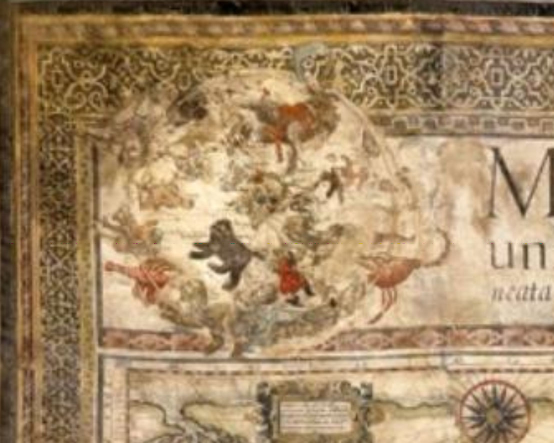
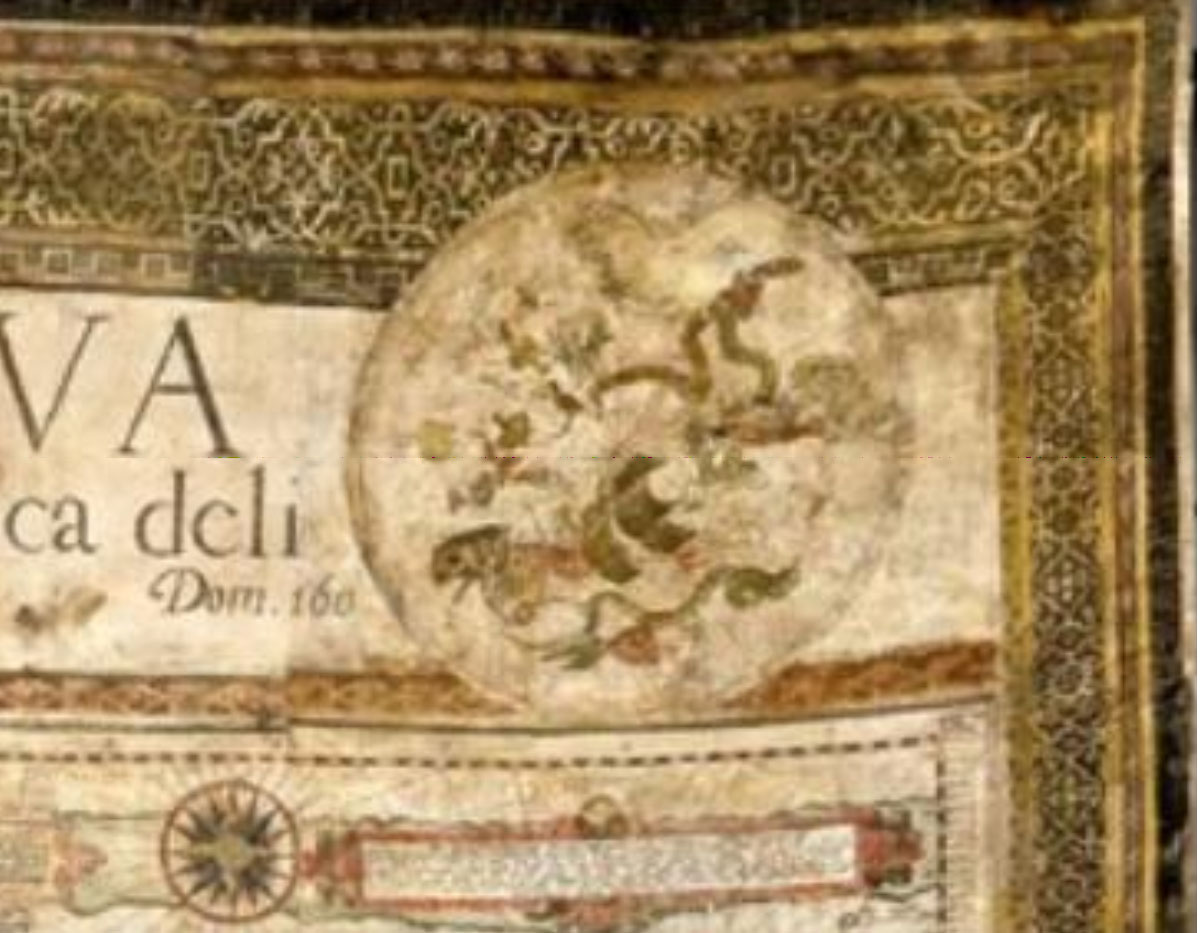
Prima tavola: i planisferi celesti
Seconda tavola
https://issuu.com/danielcrouchrarebooks/docs/catix

di FELICE STOPPA
OTTOBRE 2021